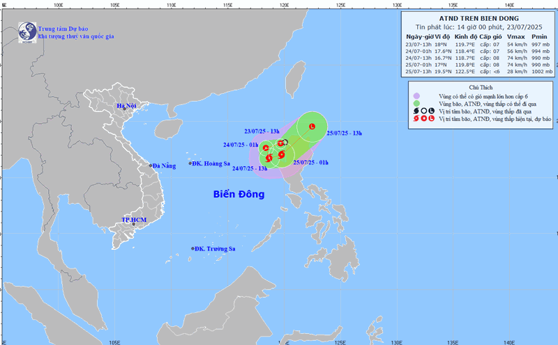
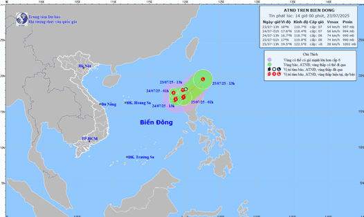
According to the latest storm information from the Joint Typhoon Warning Center (JWTC), Typhoon No. 4 Co May (international name: Co-may) has weakened into a low pressure remnant area moving deep into the mainland of Hop Phi (Anhui Province, China).
As of the morning of August 1, the remnants of the storm were located about 9km west of Shanghai, China. The low pressure is moving northwest at a speed of about 11km/h, with waves of 5.2m high.
The remnants of Co May may move into the Hoang Hai sea and gradually dissipate. This remnant area is predicted to have no chance of strengthening again.
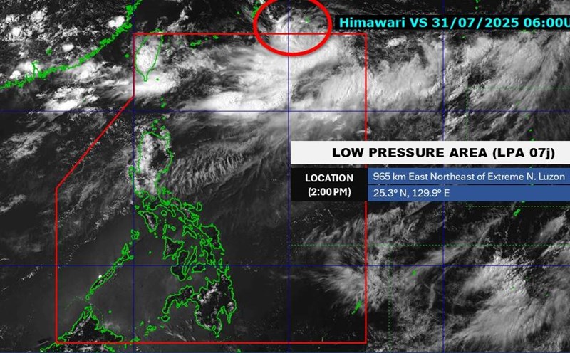
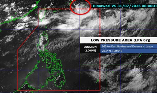
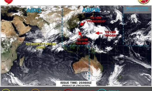
Meanwhile, the low pressure near the East Sea is located near the Daito Islands (Japan). The strongest wind near the center of the low pressure reaches about 25-35km/h.
The low pressure will turn East - Northeast away from the East Sea and will soon leave the Philippine Area of Responsibility. Therefore, the low pressure has little impact on the country's sea and mainland areas.
The low pressure is forecast to have little chance of developing into a tropical depression in the next 24 hours.
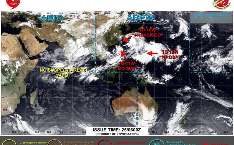
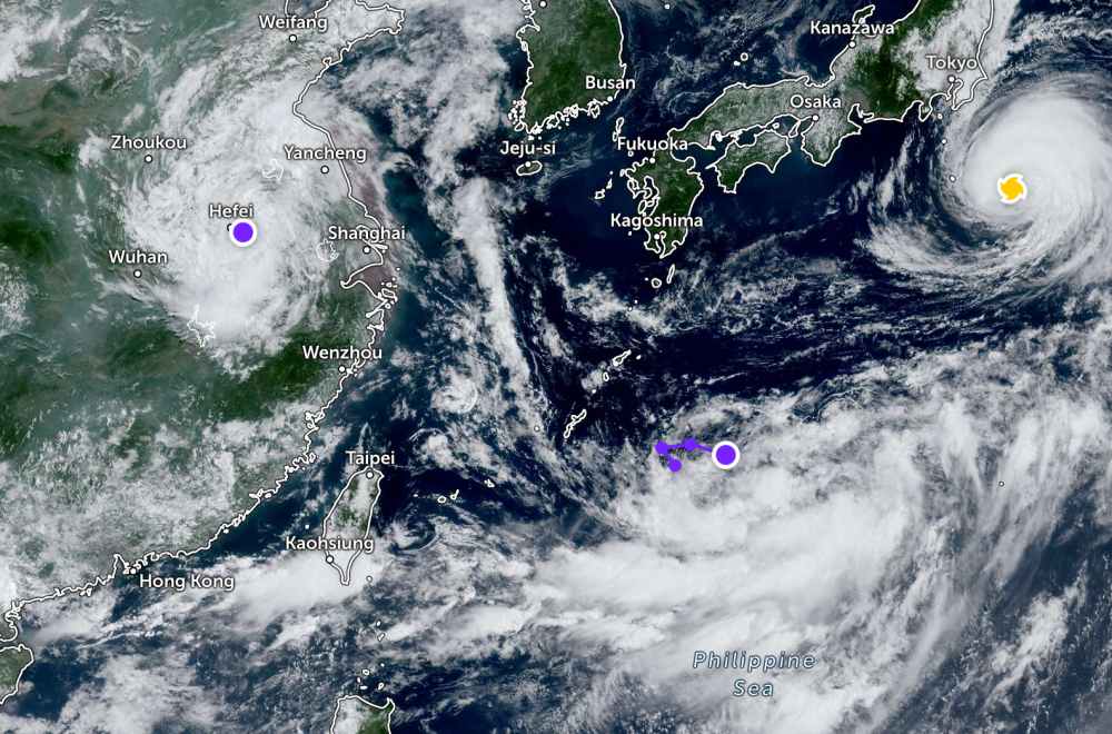
In addition, Typhoon Krosa is still active at sea, heading towards Tokyo (Japan). However, the storm is not expected to make landfall in the country. Typhoon Krosa will intensify violently in the next 24 hours.
In the East Sea, according to the National Center for Hydro-Meteorological Forecasting, in the northern sea area of the North Gulf of Tonkin and the North East Sea, there will be scattered showers and thunderstorms.
Forecast for the day and night of August 1, the North and Central East Sea (including Hoang Sa special zone) and the sea area from Gia Lai to Lam Dong will have strong winds of level 6, gusting to level 7-8. Rough seas, waves 2-4m high.
In addition, during the day and night of August 1, the northern Gulf of Tonkin, the northern sea area of the northern East Sea, the sea area from Ca Mau to An Giang and the Gulf of Thailand will have scattered showers and thunderstorms. During thunderstorms, there is a possibility of tornadoes and strong gusts of wind of level 7-8.
During the day and night of August 2, the North and Central East Sea (including Hoang Sa special zone): Strong southwest winds of level 6, gusting to level 7-8. The sea area from Gia Lai to Khanh Hoa has strong southwest winds of level 5, sometimes level 6, gusting to level 7. Waves 2-4m high, rough seas.
People and tourists planning to visit these coastal areas should pay attention to weather forecasts. Tuan followed local instructions to ensure safety throughout the journey.