According to the latest storm information from the Philippine Atmospheric, Geophysical and Astronomical Services Administration, as of 5:00 p.m. on July 22, the tropical depression east of Aurora (Philippines) has developed into a tropical depression.
The center of the tropical depression is located at about 18.3 degrees North latitude - 132.4 degrees East longitude, about 1,115 km northeast of Central Luzon or about 1,130 km east of Bac Luzon.
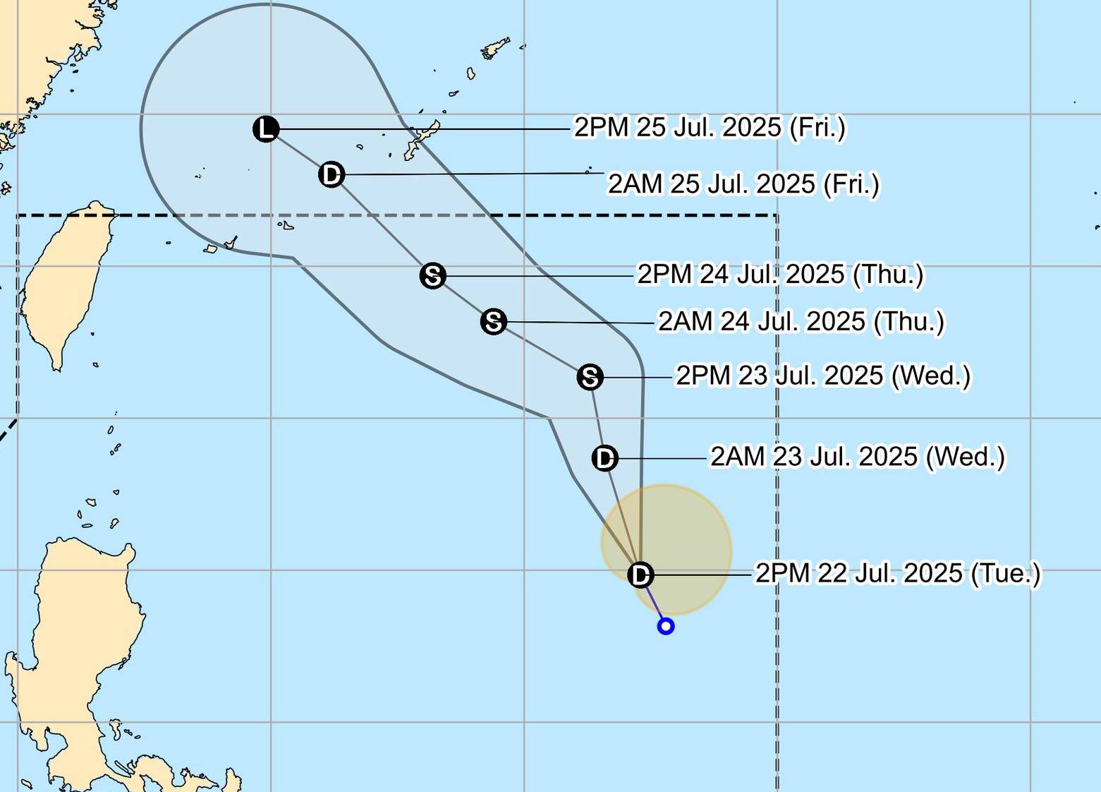
The strongest wind intensity near the center of the tropical depression reached 45km/h, gusting up to 55km/h. The low pressure is moving northwest at a speed of 20km/h. Strong winds extended outward from the center of the tropical depression up to 220 km.
The forecast of tropical depression Dante can strengthen into tropical storms tomorrow 23.7. Not excluding the possibility of storms will continue to strengthen into serious tropical storms.
Due to the influence of the low pressure, strong winds and heavy rain appeared in the areas of Zambales, Bataan, Metro Manila, Calabazon, Mimaropa, Visayas and Dinagat Islands.
At sea, waves as high as 3 m may appear on the coasts of the Batanes and Kalayaan Islands, the west coasts of Zambales, Bataan, Lubang Island, Occidental Mindoro and Calamian Islands.
PAGASA forecasts that the tropical depression will move north or northwest across the Philippine Sea from tonight to tomorrow (July 23), before turning northwest towards Taiwan (China).
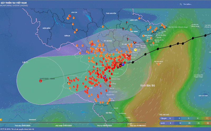
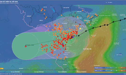
Meanwhile, Typhoon No. 3 Wipha has weakened into a tropical depression on the mainland of Vietnam.
According to the National Center for Hydro-Meteorological Forecasting, at 7:00 p.m. on July 22, the center of the tropical depression was at about 20.1 degrees North latitude - 105.6 degrees East longitude, on the mainland of Ninh Binh - Thanh Hoa. The strongest wind near the center is level 6-7 (39-61km/h), gusting to level 9. The tropical depression is moving westward at a speed of 5-10km/h.
It is forecasted that by 7:00 a.m. on July 23, the tropical depression will continue to move in the West Southwest direction, at a speed of about 10km/h and gradually weaken into a low pressure area. The forecast location is at about 19.9 degrees North latitude - 104.4 degrees East longitude, in the Upper Laos area.
From the night of July 22 to the morning of July 23, Thanh Hoa, Nghe An, the south of Phu Tho and Son La will have heavy to very heavy rain. Rainfall: 4080mm, some places over 150mm.
People and tourists should avoid going out during heavy rains and storms. Regularly monitor weather forecasts and follow local instructions to ensure safety.