Low pressure near the East Sea moves inland, causing heavy rain

Chí Long |

The low pressure near the East Sea is forecast to enter the mainland of the Philippines.

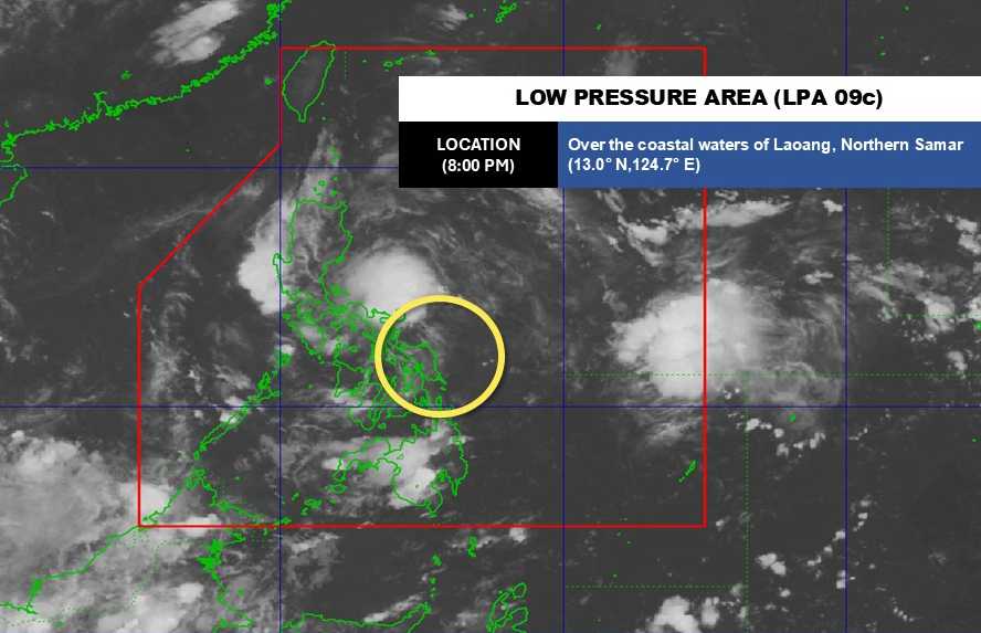
According to the latest weather forecast from the Philippine Atmospheric, Geophysical and Astronomical Services Administration, a low pressure near the East Sea is approaching the Philippine mainland.

As of 8:00 p.m. on September 13, the center of the low pressure was at about 13.0 degrees North latitude - 124.7 degrees East longitude, in the coastal area of Laoang, Northern Samar.

The low pressure is forecast to have little chance of developing into a tropical depression in the next 24 hours.

Cap nhat vi tri cua ap thap gan Bien Dong. Anh: PAGASA
Updated location of the low pressure near the East Sea. Photo: PAGASA

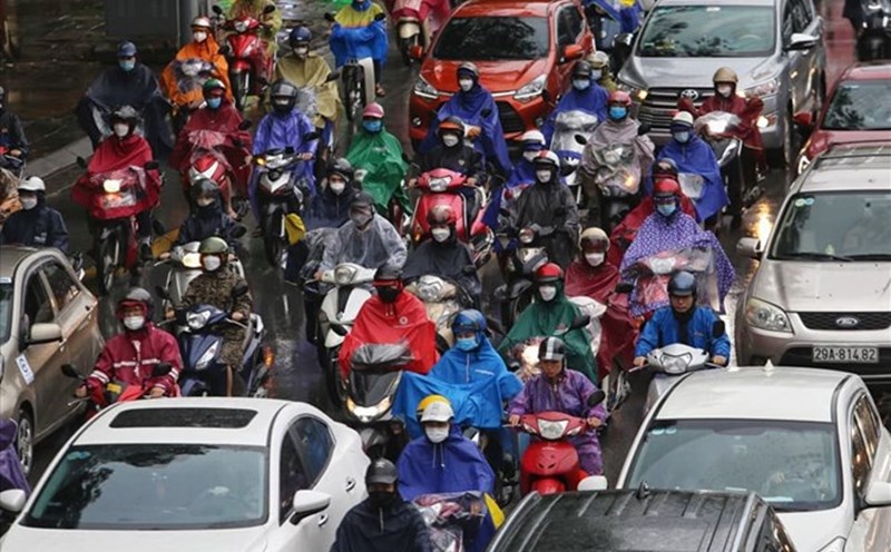
Due to the influence of the low pressure, from September 13 to the afternoon of September 14, the areas of Quezon, Marinduque, Camarines Norte, Camarines Sur, Catanduanes and Albay will have heavy rain. Rainfall is generally 50-100 mm.

From the afternoon of September 14 to the afternoon of September 15, Quezon will continue to experience heavy rain with rainfall reaching 50-100 mm.

Rainfall is forecast to reach higher in mountainous and plateau areas. Heavy rain can cause flash floods and landslides in some areas.

According to the National Center for Hydro-Meteorological Forecasting, from the night of September 13 to September 14, the sea area from Gia Lai to Ca Mau, Ca Mau to An Giang, the Gulf of Thailand, the Central and South East Sea (including Truong Sa specialties) will have scattered showers and thunderstorms.

During thunderstorms, there is a possibility of tornadoes and strong gusts of wind of level 6-7. Waves are over 2.0m high. All ships operating in the above areas are at risk of being affected by tornadoes and strong gusts of wind.

People and tourists coming to the Philippines or these coastal areas should pay attention to weather forecasts. Check flight schedules and follow local instructions to proactively plan travel and ensure safety.

Chí Long
TIN LIÊN QUAN

Low pressure sweeps across the mainland approaching the East Sea, heavy rain

|

The low pressure near the East Sea combined with the easterly winds will cause widespread thunderstorms when passing through the Philippines, visitors should pay attention to the risk of flash floods and landslides.

Weather forecast for today, September 14: Heavy rain in the North, sunny in the North Central region

|

Weather forecast for today, September 14, the Northern region will have scattered showers and thunderstorms, in the evening, some places will have heavy to very heavy rain, the North Central region will have sunny days.

Low pressure sweeps across the mainland approaching the East Sea, heavy rain

Ninh Phương |

The low pressure near the East Sea combined with the easterly winds will cause widespread thunderstorms when passing through the Philippines, visitors should pay attention to the risk of flash floods and landslides.

Weather forecast for today, September 14: Heavy rain in the North, sunny in the North Central region

Chí Long |

Weather forecast for today, September 14, the Northern region will have scattered showers and thunderstorms, in the evening, some places will have heavy to very heavy rain, the North Central region will have sunny days.

Áp thấp gần Biển Đông tiến sát đất liền, dự báo khả năng thành bão

Ninh Phương |

Theo tin dự báo thời tiết mới nhất, áp thấp gần Biển Đông có thể duy trì cường độ hoặc mạnh lên thành áp thấp nhiệt đới.