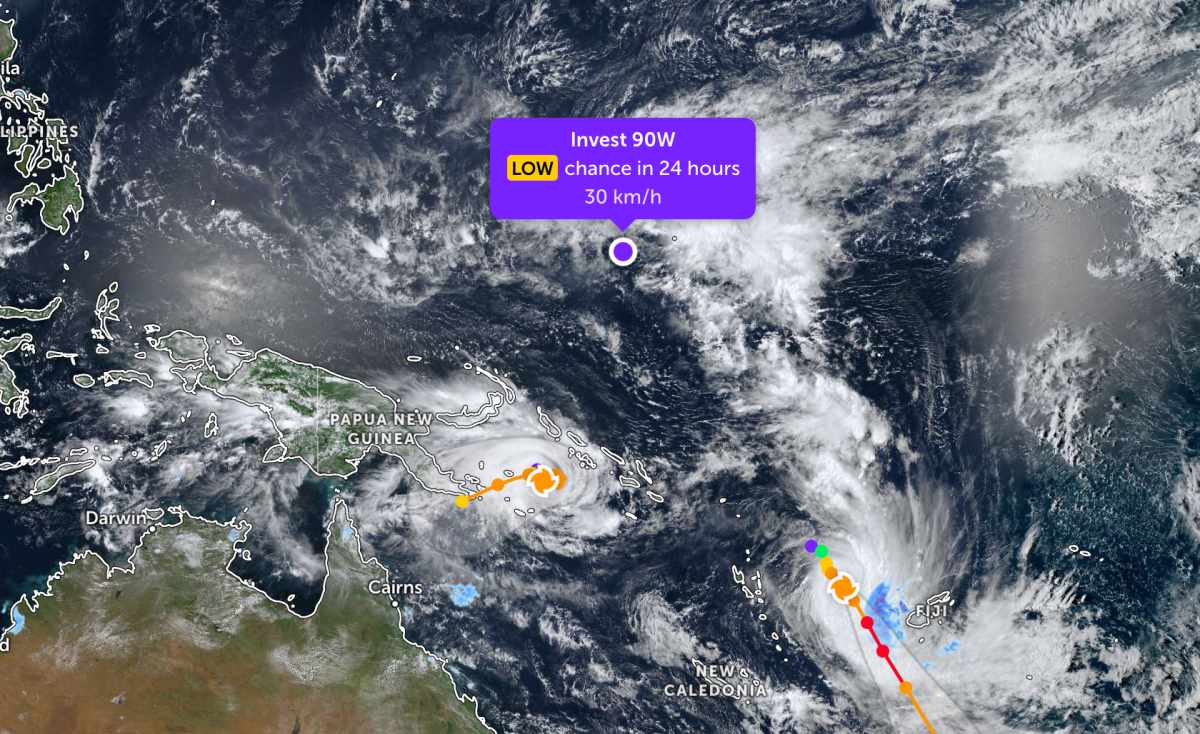
According to storm news, the latest low pressure from the Joint Typhoon Warning Center (JTWC), a new low pressure has formed in the Pacific Ocean.
As of the morning of April 6, the low pressure bearing the symbol Invest 90W is currently located in the western Pacific region. The strongest wind near the center of the low pressure reaches 30 km/h.
The low pressure is unlikely to develop into a tropical depression in the next 24 hours.
Meanwhile, Typhoon Vaianu is strongly strengthening in the Pacific Ocean.
The center of Typhoon Vaianu is currently located about 624 km west-northwest of Suva (Fiji). In the past 6 hours, the typhoon has moved in a Southeast direction at a speed of 15 km/h. The maximum wave height reached 7.9 m.
The strongest wind near the storm center reaches 150 km/h. It is forecast that in the next 2 days, the storm will strengthen fiercely with a maximum speed of up to 195 km/h. After that, the storm will gradually weaken into a tropical depression.
Not far from there, storm Maila is currently located about 1,265 km northeast of Cairns (Australia). In the past 6 hours, the storm has moved in an East direction at a speed of 2 km/h. The maximum wave height reached 8.5 m.
It is forecasted that in the next 2 days, Maila will continue to be in the area affected by opposite high pressure systems, sandwiched between high pressure bands in both the north and south. Therefore, the storm tends to move very slowly and the direction may fluctuate unpredictably.
Currently, Typhoon Maila is forecast to complete a counterclockwise cycle within the next 2 days. After that, the typhoon will accelerate and move west-southwest in the next 5 days, before gradually weakening.
Because it is still quite far from the mainland, storms and low pressures have not caused much impact on nearby mainland areas. However, people and tourists coming to storm-prone areas should pay attention to weather forecasts. Check flight schedules and follow local instructions to avoid dangerous storms.


