According to storm news, the latest low pressure from the Joint Typhoon Warning Center (JTWC), a new low pressure has formed in the Pacific Ocean.
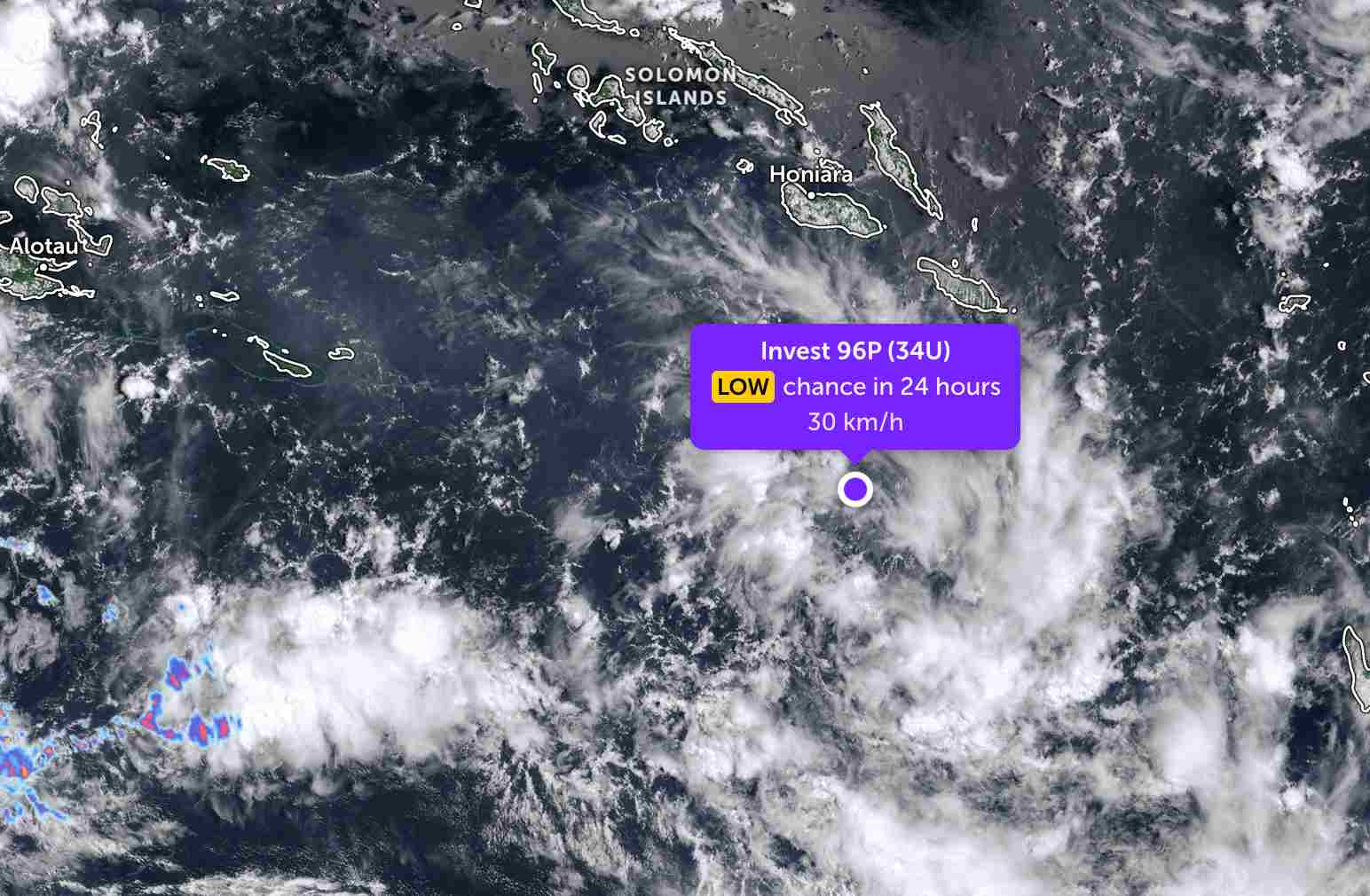
The low pressure bearing the symbol Invest 96P (Tropical Low 34U) is currently located south of the Solomon Islands in the Pacific Ocean. The strongest wind near the center of the low pressure reaches 30 km/h.
The low pressure is forecast to have little chance of developing into a tropical depression in the next 24 hours.
Located near the Solomon Islands, the low pressure caused thunderstorms on many small islands in this archipelago.
In the East Sea, according to the National Center for Hydro-Meteorological Forecasting, today, March 15, the northeastern sea area of the North East Sea area has strong Northeast winds at level 6.
Forecast for the day and night of March 15, the east of the Northern East Sea area has level 6 Northeast wind, gusts of level 7-8; rough seas. Sea waves are 3.0-5.0m high, Northeast direction.
The sea area from Khanh Hoa to Vinh Long and the west of the South East Sea area (including the western Truong Sa special zone) has Northeast wind level 6, gusts level 7-8 during the day; rough seas. Night winds gradually decrease. Sea waves are 2.0-4.0m high, Northeast direction.
On March 16, the northeastern sea area of the Northern East Sea has strong Northeast wind at level 6, gusts at level 7-8; rough seas; sea waves 3.0-5.0m high; night of March 16, wind gradually decreases.
People and tourists planning to visit these sea areas should pay attention to weather forecasts. Follow local instructions and avoid going to sea when the sea is rough to avoid thunderstorms at sea that are dangerous.


