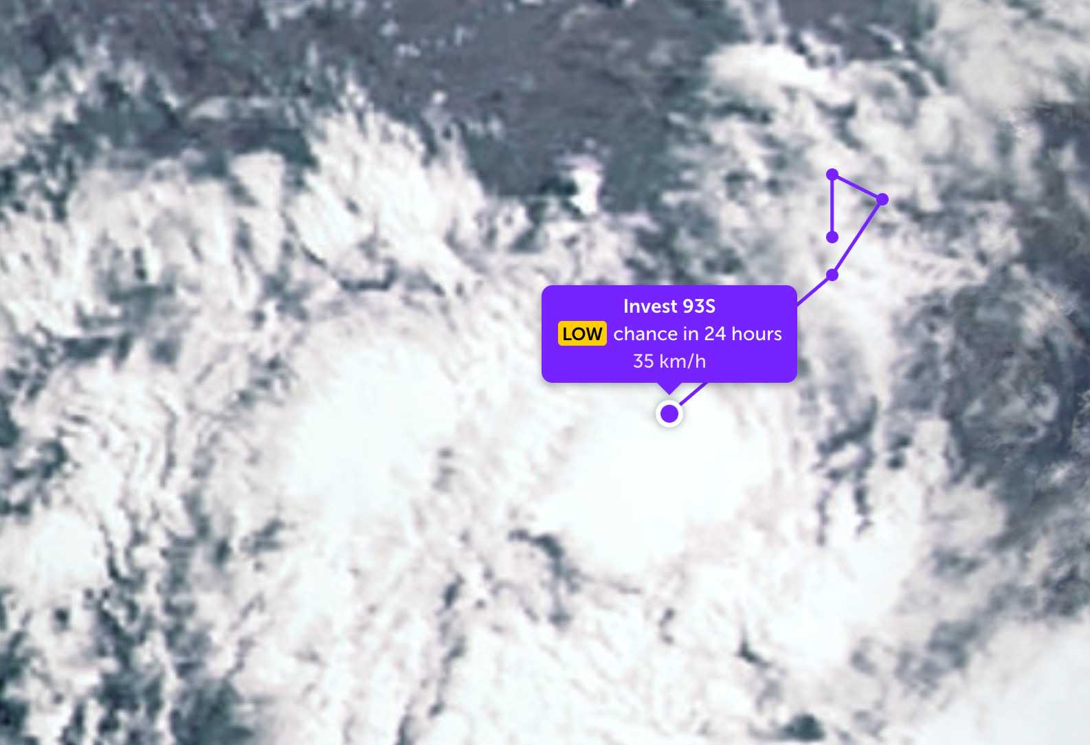
According to storm news, the latest low pressure from the Joint Typhoon Warning Center, a new low pressure has formed in the Indian Ocean.
As of the morning of May 7, the center of the low pressure bearing the symbol Invest 93S is currently located in the Southwest Indian Ocean. In the past 24 hours, the low pressure has moved in a circular motion with a small in situ radius, before turning southwest.
The strongest wind near the center of the low pressure reached 35 km/h, gusting up to 45 km/h. The low pressure is unlikely to develop into a tropical depression in the next 24 hours.
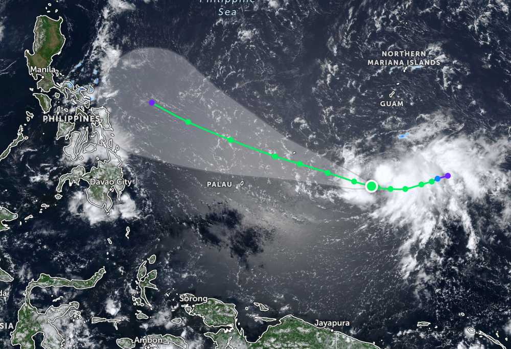
Meanwhile, Typhoon Hagupit continues to operate strongly in the Pacific Ocean. The storm's center is located at about 7.3 degrees North latitude - 143.8 degrees East longitude, 1,930 km east of the Northeast of Mindanao.
The strongest wind near the storm center reached 65 km/h, gusting up to 80 km/h. The storm is moving in a westerly direction at a speed of 15 km/h.
On the other hand, the low pressure bearing the symbol 05a was in the waters off the coast of Hinatuan, Surigao del Sur. The strongest wind near the center of the low pressure reached 30 km/h. The low pressure made landfall, causing large waves and thunderstorms on the sea and land around the area.
In the East Sea, according to the National Center for Hydro-Meteorological Forecasting, the area north of the Gulf of Tonkin at night has scattered showers and thunderstorms, in thunderstorms there is a possibility of tornadoes and strong gusts of wind. Southeast to south wind level 3-4, from near morning turns to Northeast and gradually strengthens to level 4-5, gusts level 6. Sea waves are 0.5 - 1.5m high, visibility over 10km, decreasing to 4-10km in rain. Meanwhile, the South of the Gulf of Tonkin has rain in a few places, Southeast wind level 3-4, waves are 0.5 - 1.5m high, visibility over 10km.
The sea area from South Quang Tri to Quang Ngai and the sea area from Gia Lai to Khanh Hoa has showers and thunderstorms in some places, visibility over 10km. Southeast wind level 3-4, especially the sea area from Gia Lai to Khanh Hoa light wind. Sea waves are common from 0.5 - 1.5m.
The sea area from Lam Dong to Ca Mau and the area from Ca Mau to An Giang has scattered showers and thunderstorms, in thunderstorms there is a possibility of tornadoes and strong gusts of wind. Visibility over 10km, reduced to 4-10km in rain. Light wind. Sea waves 0.5 - 1.5m high, especially the sea area from Ca Mau to An Giang waves 0.5 - 1.0m high.
In the North East Sea area, the central East Sea area, the South East Sea area and the Hoang Sa special zone and Truong Sa special zone have showers and thunderstorms in some places, visibility over 10km. Light wind, especially the South East Sea area and Truong Sa special zone have northeast to easterly winds of level 3-4. Sea waves are commonly 0.5 - 1.5m high, especially the North East Sea is 1.0 - 2.0m high.
People and tourists who plan to go to these sea areas or places where low pressure passes should pay attention to weather forecasts. Avoid going out to sea when the sea is rough and follow local instructions to avoid storms and big waves at sea that are dangerous.


