According to storm news, the latest low pressure from the Philippine Atmospheric, Geophysical and Astronomical Services Administration (PAGASA), a low pressure is approaching the mainland area of this country.
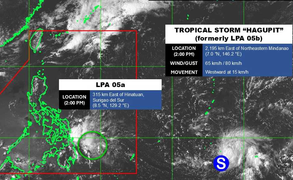
As of 2 pm today (local time), the center of the low pressure was located at about 8.5 degrees North latitude - 129.2 degrees East longitude, about 315 km east of Hinatuan, Surigao del Sur.
The strongest wind near the center of the low pressure reached 30 km/h. The low pressure is unlikely to develop strongly into a tropical depression or storm in the next 24 hours.
Due to the influence of the low pressure, the eastern Visayas, Caraga, Davao Region, Bohol, Siquijor, Misamis Occidental, Misamis Oriental and Camiguin areas are cloudy, with scattered showers and thunderstorms. Risk of flash floods or landslides due to moderate rain, sometimes heavy rain.
Meanwhile, Typhoon Hagupit is active in the Pacific Ocean. The storm's center is located at about 7.0 degrees North latitude - 146.2 degrees East longitude, about 2,195 km east of the Northeast of Mindanao.
The strongest wind near the storm center reached 65 km/h, gusting up to 80 km/h. The storm is moving in a westerly direction at a speed of 15 km/h.
Storm Hagupit causes thunderstorms and gusts of wind at sea. However, because it is still quite far away, the storm has not affected much the surrounding land areas.
People and tourists planning to go to areas affected by low pressure and places with storms should pay attention to weather forecasts. Check flight schedules and follow local instructions to avoid storms and big waves at sea that are dangerous.


