According to storm news, the latest low pressure from the Joint Typhoon Warning Center (JTWC), a low pressure is moving in the South Pacific region.
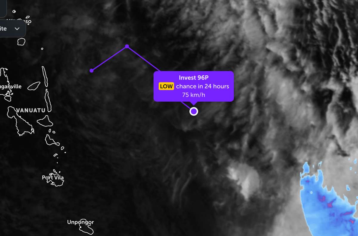
The low pressure bearing the symbol Invest 96P is currently located near the Vanuatu area in the South Pacific. The strongest wind near the center of the low pressure reaches 75 km/h.
This low pressure area is currently classified as a subtropical depression. However, the low pressure area is forecast to have a low probability of developing into a tropical depression or storm in the next 24 hours.
In the past 24 hours, the low pressure has moved in a circular motion from Northeast to Southeast. Then, forecast models all suggest that this low pressure will move in a Southeast direction, towards the south of the Fiji Islands in the next 24 hours.
The system is forecast to increasingly be affected by strong westerly winds at mid-latitude and turn into an extratropical depression as an upper trough rises to cover the entire system.
Due to the influence of the low pressure, on June 16, the Fiji archipelago area will have scattered thunderstorms, with heavy rain in some places. By June 17, the weather will be less cloudy and sunny. However, thunderstorms will return from June 19 to the end of the week.
Meanwhile, the low pressure bearing the symbol Invest 92W is currently operating in the Western Pacific region. The strongest wind near the center of the low pressure reaches 35 km/h, gusting up to 45 km/h.
The low pressure moves in a West-Northwest direction in the next 2 days, towards the Philippine Area of Responsibility (PAR). However, the low pressure is forecast to have little chance of developing strongly into a tropical depression or storm.
Tourists planning to visit the Fiji Islands during this time should pay attention to weather forecasts. Check your flight schedule and follow local instructions to avoid storms affecting your journey.


