According to storm and low pressure news from the Philippine Atmospheric, Geophysical and Astronomical Services Administration (PAGASA), the tropical depression operating in the sea area southeast of Luzon Island has strengthened into a tropical storm.
As of 10:00 PM on June 19th, the storm's center was located at about 14.1 degrees North latitude - 139.7 degrees East longitude, about 1,675km southeast of Luzon Island. The strongest wind near the storm's center reached 65km/h, gusting to 80km/h, and the central pressure was about 1,002 hPa.
The storm is moving in a West-Northwest direction at a speed of about 25km/h. The strong wind area from level 6 or higher expands within a radius of about 280km from the storm center.
Forecast for the next 24-48 hours, the storm will continue to move mainly in the West-Northwest direction and is likely to enter the Philippine Area of Responsibility (PAR) from the evening of June 20 to the morning of June 21. When entering PAR, the storm will be named Francisco locally.
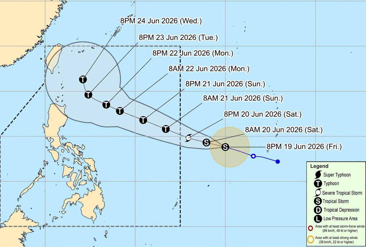
The Philippine meteorological agency believes that the possibility of the storm making landfall is currently not high. However, the storm is forecast to continue to strengthen and may reach typhoon level on June 21.
Because the typhoon's trajectory may approach the Northern Philippines area on June 23-24, the possibility of issuing level 1 wind warning signals for some areas north and east of Luzon Island has not been ruled out.
In the next 3 days, the storm is assessed to have little potential to directly affect the weather and sea conditions on Philippine territory.
People and tourists are advised to continue to closely monitor the new developments of the storm. Follow local instructions and avoid going out to sea when the sea is rough to ensure safety.


