Theo tin dự báo thời tiết mới nhất từ Cục Quản lý Thiên văn, Địa vật lý và Khí quyển Philippines (PAGASA), áp thấp nhiệt đới gần Biển Đông đang tiến về phía đất liền Philippines.
As of 8 am today (local time), the center of the tropical depression is located at about 8.7 degrees North latitude - 133.0 degrees East longitude, about 1,075 km east of Hinatuan, Surigao del Sur.
The strongest wind in the area near the center of the tropical depression reached 55 km/h, gusting up to 70 km/h. The tropical depression is moving slowly in a Northwest direction at a speed of 15 km/h.
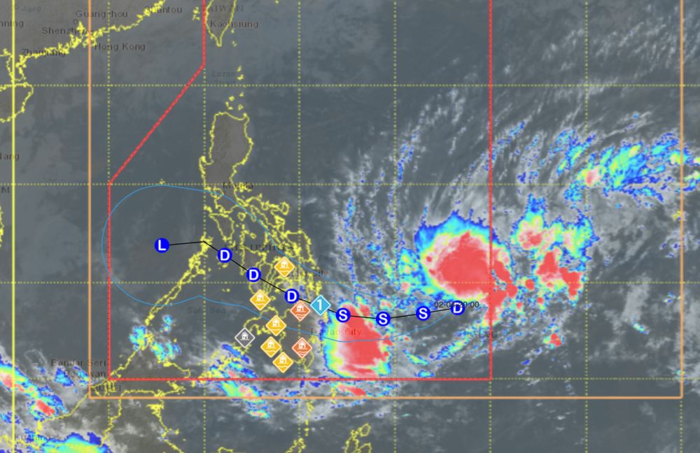
PAGASA dự báo áp thấp nhiệt đới sẽ mạnh lên thành bão vào khoảng 8h tối nay 4.2. (theo giờ địa phương).
Do ảnh hưởng của áp thấp nhiệt đới, từ nay đến chiều mai, một số khu vực gồm Quần đảo Dinagat, Surigao del Norte, Surigao del Sur và Davao Oriental đón lượng mưa từ 50-100 mm. Từ ngày mai 5.2, mưa sẽ lan rộng và dữ dội hơn ở nhiều khu vực trên đất liền Philippines.
In the East Sea, according to the National Center for Hydro-Meteorological Forecasting, today, February 4, the northeastern sea area of the Northern East Sea has level 6 Northeast wind, gusts of level 7-8; waves 3.0-5.0m high; rough seas.
Sea area from Khanh Hoa to Ho Chi Minh City and sea area west of the South East Sea (including sea area west of Truong Sa special zone): Northeast wind level 6, gusts level 7-8; waves 2.0-4.0m high; rough seas.
On the night of February 4th, the wind in the sea areas tends to gradually decrease. Ships operating in the above sea areas are at high risk of being affected by strong winds and large waves.
People and tourists coming to these sea areas or areas with tropical depressions should pay attention to weather forecasts. Follow local instructions to avoid strong winds and big waves at sea causing danger.


