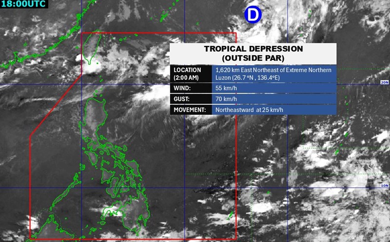
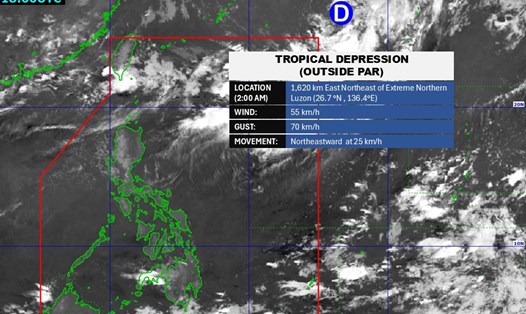
The tropical depression is moving northeast, unlikely to make landfall.
According to the Philippine Atmospheric, Geophysical and Astronomical Services Administration (PAGASA), the tropical depression will not directly affect the mainland.
If it officially enters the Philippine Area of Responsibility (PAR), the tropical depression that will strengthen into a storm will be named Fabian, becoming the first storm in August and the sixth storm in 2025 in the Philippines.
This is unlikely with the current forecast for the tropical depression's path.
The Joint Typhoon Warning Center (JTWC) is also monitoring the tropical depression with the symbol 13W.
According to the latest news, the tropical depression is located about 520 km west-northwest of Iwo To Island (Japan), moving northeast at a speed of 11 km/h. The strongest wind near the center reaches 55 - 70km/h, with the highest wave reaching about 4.9m.
It is forecasted that in the next 2-3 days, the tropical depression will continue to move further northeast, unlikely to directly affect the mainland.
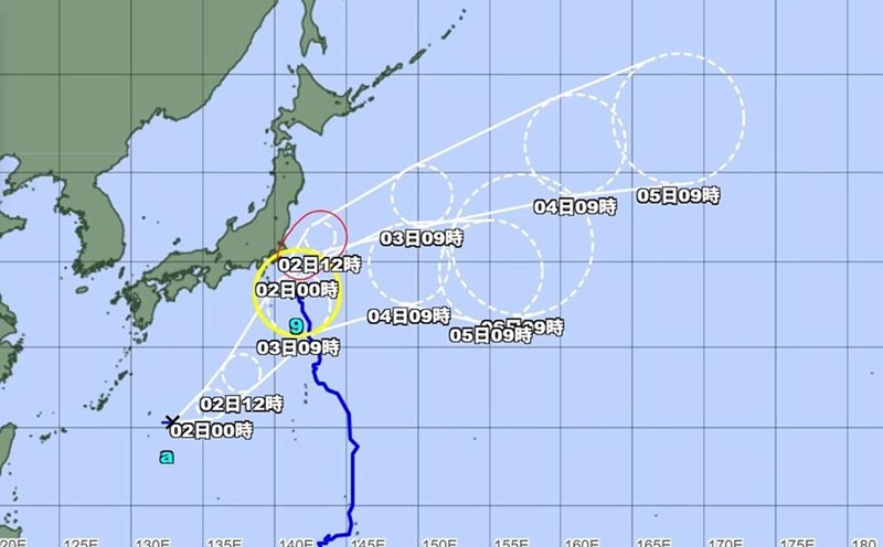
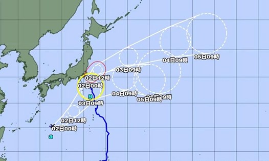
However, the tropical depression is likely to move towards Typhoon Krosa, which is gathering off the coast of Senda, Japan. The JWTC forecasts that the depression will strengthen into a tropical storm with winds of about 65 - 75 km/h in the next 2-3 days.
Typhoon Krosa is currently located about 213 km east-northeast of Narita Airport. In the past 6 hours, the storm has been moving northeast at a speed of about 26 km/h.
Waves in the storm's eye could reach nearly 8 meters, endangering maritime activities.
It is forecasted that in the next 12 hours, the storm will continue to maintain its current intensity, before gradually weakening, with winds decreasing to about 55 km/h.
Although tropical depression and storm Krosa do not directly affect the mainland, tourists in coastal areas of the North Philippines, Taiwan (China), Japan or planning to travel by sea in the Northwest Pacific should closely monitor weather forecasts, beware of heavy rain, rough seas or postpones - cancels their trips.
Tourists should prepare raincoats, check weather conditions at their destination, and follow the instructions of authorities if there are warnings.