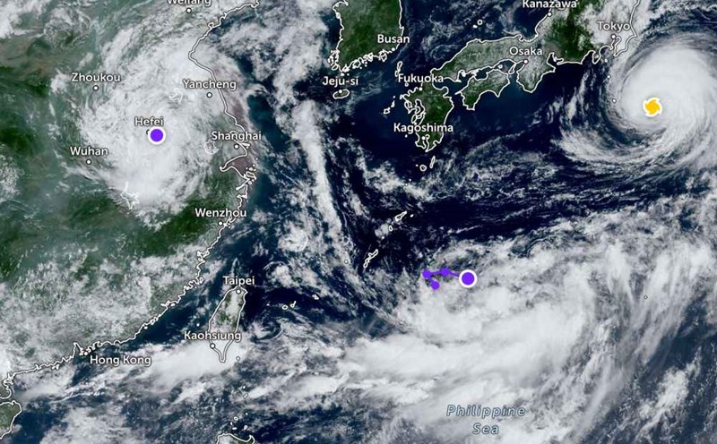
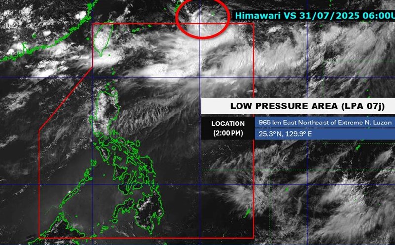
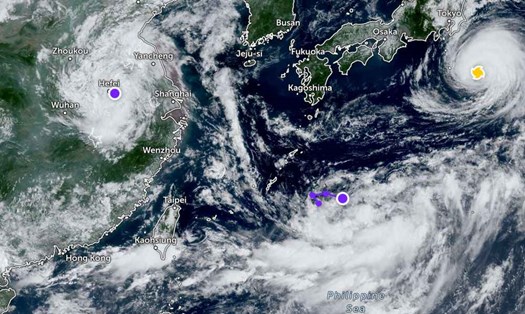
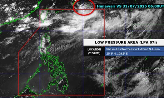
According to the latest tropical depression information released at 4:00 a.m. this morning (August 2) by the Philippine Atmospheric, Geophysical and Astronomical Services Administration (PAGASA), a tropical depression outside the Philippine Area of Responsibility was recorded about 1,635 km from the farthest north of Luzon to the northeast, with maximum winds of 55 km/h, gusts of up to 70 km/h, moving northeast at a speed of 25 km/h.
Meanwhile, the Joint Typhoon Warning Center (JWTC) forecasts that the tropical depression will tend to move northeast and gradually strengthen in the next 24-36 hours.
Currently, the tropical depression has not directly affected the weather in the East Sea.
According to the National Center for Hydro-Meteorological Forecasting, the eastern sea of the North East Sea has seen strong southwest winds of level 6. At the same time, the northern Gulf of Tonkin and the northern sea of the North East Sea will have scattered showers and thunderstorms.
It is forecasted that in the next 24 hours (day and night, December 8), the northeastern sea of the East Sea will continue to have strong southwest winds of level 6, gusting to level 7-8, rough seas, waves from 2.0 to 4.0m high. The area between the East Sea and the sea area from Gia Lai to Lam Dong has southwest winds of level 5, sometimes level 6, gusting to level 7-8; rough seas with waves 2.0-3.5m high.
In addition, the northern sea area of the North East Sea will continue to have scattered showers and thunderstorms. During thunderstorms, there is a possibility of tornadoes and strong gusts of wind.
Warning for the day and night of August 23, the northeastern sea area of the East Sea will maintain strong southwest winds of level 5, sometimes level 6, gusting to level 7. Waves are 2.0-3.5m high, rough seas.
Tourists who are or are about to travel to southern Japan, Taiwan, Okinawa or the sea area northeast of Luzon should closely monitor weather reports, especially in the next 24-48 hours.
Limit going out to sea or participating in outdoor activities when there are warnings of thunderstorms or rough seas.