
According to storm news, the latest low pressure from the Philippine Atmospheric, Geophysical and Astronomical Services Administration (PAGASA), a low pressure near the East Sea has strengthened into a tropical depression.
As of 10 am this morning, July 13 (local time), tropical depression Haishen formed from a low pressure area in the East of the Visayas region, currently still outside the Philippine Area of Responsibility (PAR). The center of the low pressure is located at about 10.7 degrees North latitude - 137.3 degrees East longitude, about 1,265 km east of Visayas.
The strongest wind in the area near the center of the tropical depression reaches 55 km/h, gusts up to 70 km/h, central pressure is 1,006 hPa. The tropical depression moves in the Northwest direction at a speed of about 30 km/h. The strong wind area caused by the low pressure expands within a radius of about 480 km.
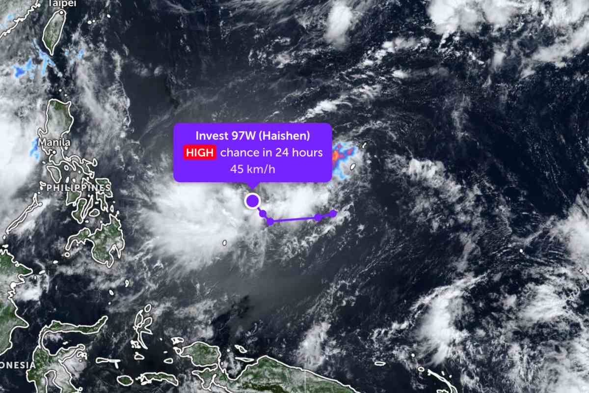
It is forecast that the tropical depression will continue to move in a Northwest direction and is likely to enter the Philippine Area of Responsibility on the evening of July 13th or the morning of July 14th. After entering PAR, the tropical depression is expected to gradually move in a North then Northeast direction before leaving this area on July 15th.
The Philippine meteorological agency believes that the tropical depression may strengthen into a storm within the next 12 hours, then gradually weaken due to unfavorable environmental conditions.
Because it is still far from the mainland, the tropical depression has not had much impact on the adjacent mainland areas.
In the East Sea, according to the National Center for Hydro-Meteorological Forecasting, in the past 24 hours, Phu Quy special zone recorded southwest wind level 6, gusts level 8-9. The sea area east of the North and Central East Sea, along with the sea area from Lam Dong to Ca Mau, from Ca Mau to An Giang and the Gulf of Thailand, experienced showers and thunderstorms.
Forecast for the day and night of July 13th, the sea area from Gia Lai to Ho Chi Minh City and the Central East Sea area will have strong southwest winds at level 6, gusts at level 7-8, rough seas. Sea waves are 2.0-3.0 m high, especially the Central East Sea area from 2.0-4.0 m.
In the Gulf of Thailand, east of the Northern East Sea area and west of the Southern East Sea area (including the sea area west of the Truong Sa special zone), strong southwest wind level 5, sometimes level 6, gusts level 7-8; rough seas with waves 1.5-3.5 m high.
In addition, the sea area from Lam Dong to Ca Mau, from Ca Mau to An Giang, the Gulf of Thailand, the east of the Northern East Sea area and the Central and Southern East Sea areas (including Truong Sa special zone) will have scattered showers and thunderstorms. In thunderstorms, there is a possibility of tornadoes, strong gusts of wind at level 7-8 and waves over 2.0 m high.
Forecast for the day and night of July 14, the sea area from Gia Lai to Lam Dong and the Central East Sea area will continue to have Southwest wind level 6, gusts level 7-8; sea waves from 2.0-4.0 m high, rough seas. East of the Northern East Sea area has Southwest wind level 5, sometimes level 6, gusts level 7-8; sea waves from 1.5-3.5 m high, rough seas.
The level of natural disaster risk due to strong winds at sea is warned at level 2. All ships operating in the above sea areas are at high risk of being affected by strong winds, large waves, tornadoes and thunderstorms.
People and tourists planning to visit these sea areas should pay attention to weather forecasts. Follow local instructions, avoid going to sea when the sea is rough to avoid heavy rain and big waves causing danger throughout the journey.


