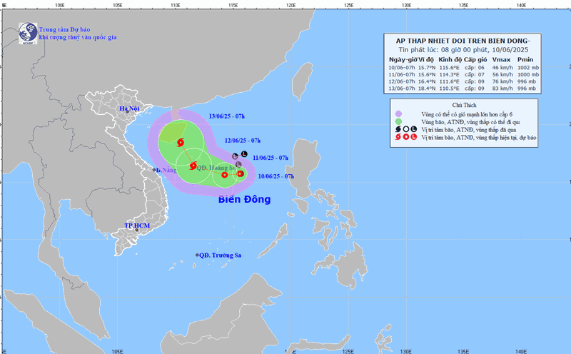
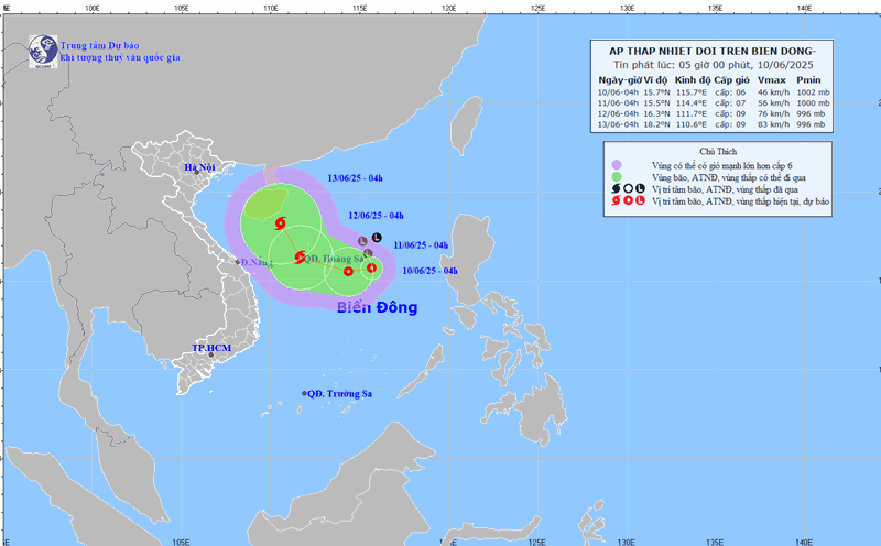
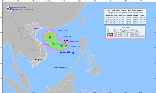
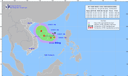
According to the National Center for Hydro-Meteorological Forecasting, at 1:00 p.m. on June 10, the center of the tropical depression was at about 15.3 degrees North latitude - 114.8 degrees East longitude, about 360km East Southeast of Hoang Sa archipelago. The strongest wind is level 6-7 (39-61km/h), gusting to level 9.
The tropical depression moved slowly in the West Northwest direction, at a speed of about 5km/h.
It is forecasted that by 1:00 p.m. on June 11, the tropical depression will move in the West Northwest direction at a speed of about 5-10km/h. The center of the tropical depression is forecast to be at about 16.2 degrees North latitude - 113.1 degrees East longitude, right in the area east of Hoang Sa archipelago. Forecast to strengthen into a storm, strong wind intensity level 8, gust level 10.
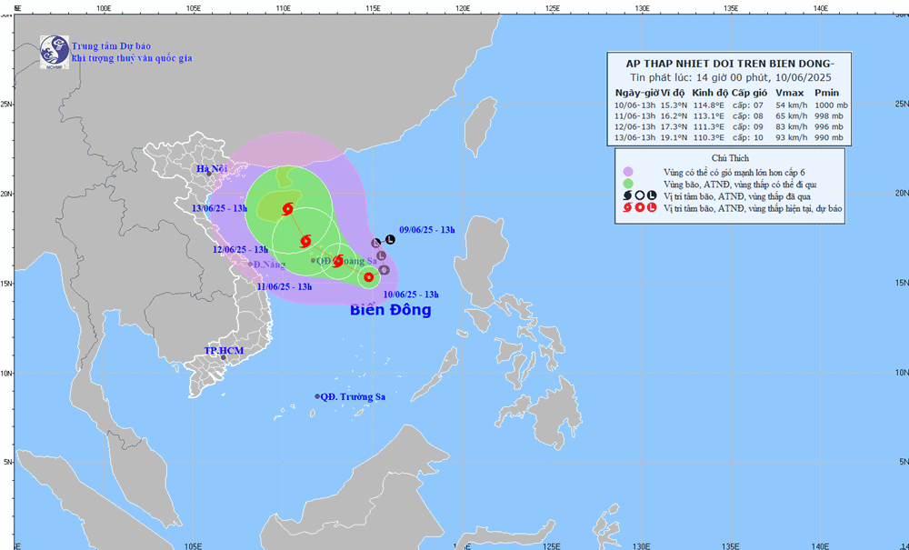
Dangerous areas at sea ( strong winds from level 6 and above) are forecast to be from 13 - 19 degrees North latitude and from 111 - 117 degrees East longitude. Disaster risk level: Level 3 in the North East Sea and the North Central East Sea.
By 1:00 p.m. on June 12, the storm is forecast to move in a West-Northwest direction at a speed of about 10km/h, continuing to strengthen. The center of the storm is forecast to be at about 17.3 degrees North latitude - 111.3 degrees East longitude, northwest of Hoang Sa archipelago. Wind intensity level 9, gust level 11.
The danger zone is expanding from 14 to 20 degrees North latitude, from 109 to 117 degrees East longitude. Natural disaster risk level: Level 3 in the North East Sea, North between the East Sea and the sea off the coast of Quang Tri to Quang Ngai.
It is forecasted that in the next 48 to 72 hours, the tropical depression (or storm) is likely to change direction, moving North Northwest, at a speed of about 10km/h and continuing to strengthen.
Due to the influence of the tropical depression, the North East Sea area (including the Hoang Sa archipelago), the North Central East Sea area will have thunderstorms and strong winds of level 6-7, then increase to level 8, gusts of level 11, waves 2.0-4.0m high, rough seas.
In the South of the Central East Sea, the South East Sea (including the Truong Sa archipelago) has strong southwest winds of level 6, sometimes level 7, gusting to level 8-9, waves 2.0-4.0m high, rough seas.
Ship operating in the above-mentioned dangerous areas are likely to be affected by thunderstorms, whirlwinds, strong winds, and large waves.
People and tourists in the Gulf of Tonkin, the sea area from Quang Tri to Quang Ngai should pay attention to weather forecasts. Check flight schedules regularly and comply with recommendations from local authorities to ensure safety against the impact of natural disasters caused by tropical depressions or storms in the East Sea.