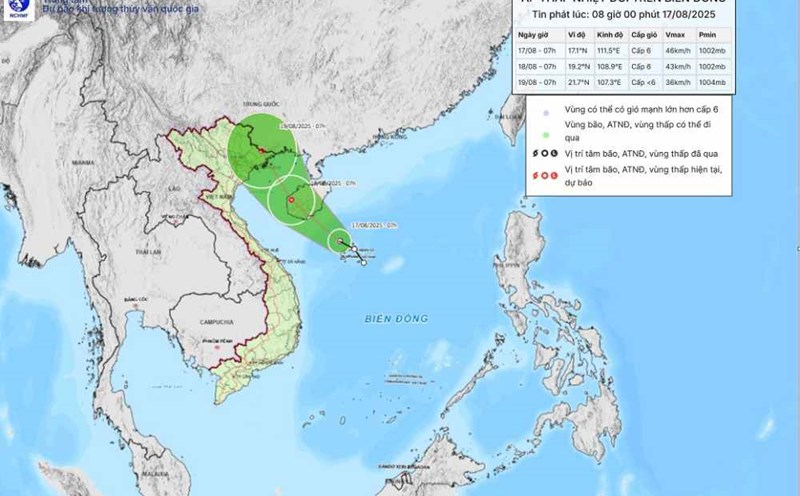
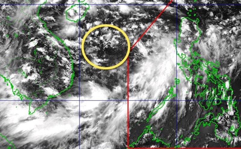
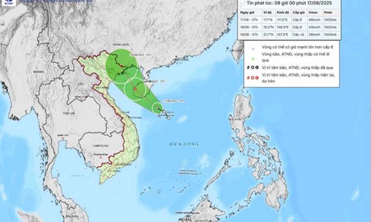
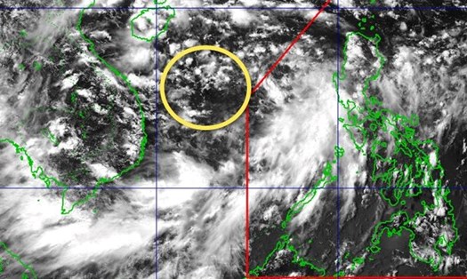
According to the latest weather forecast from the National Center for Hydro-Meteorological Forecasting, at 1:00 p.m. on August 17, the center of the tropical depression was at about 17.4 degrees North latitude; 111.1 degrees East longitude, in the sea northwest of Hoang Sa.
The strongest wind is level 6 (39-49 km/h), gusting to level 8, moving northwest at 15 km/h.
At 1:00 p.m. on August 18, the center of the tropical depression was at about 19.5 degrees North latitude - 108.3 degrees East longitude, in the North of the Gulf of Tonkin.
The tropical depression is moving northwest at a speed of about 15km/h, with strong winds of level 6, gusting to level 8.
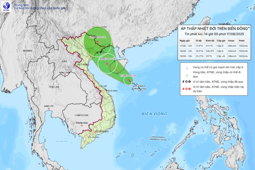
The danger zone is determined to be from 16.5 to 20.5 degrees North latitude and from 107.0 to 112.0 degrees East longitude. The natural disaster risk level is level 3, directly affecting the western sea area of the North East Sea (including the Hoang Sa archipelago) and the Gulf of Tonkin (including Bach Long Vi island).
By 1:00 p.m. on August 19, the tropical depression is forecast to move north-northeast at a speed of 10-15km/h and gradually weaken into a low pressure area. The center is currently located at about 22.2 degrees North latitude - 107.0 degrees East longitude, in the area south of Guangxi province (China). The wind intensity decreased to below level 6.
The danger zone will expand to the north of the latitude of 18.5 degrees North latitude and the west of the longitude of 109.5 degrees East longitude. The natural disaster risk level remains at level 3, affecting the Northern Gulf of Tonkin, including Bach Long Vi Island and Co To Island.
Due to the influence of the tropical depression, in Huyen Tran and Phu Quy, there are southwest winds of level 6, gusting to level 8-9; Bach Long Vi has gusts of level 7; Hon Ngu has gusts of level 8.
The northwest sea area of the East Sea (including Hoang Sa): strong winds of level 6-7, gusts of level 8-9, rough seas, waves 2.0-3.5m high.
Gulf of Tonkin: winds gradually increase to level 6, gusting to level 8, rough seas, waves 2.0-3.0m high.
From Khanh Hoa to Lam Dong and the Central East Sea area: Southwest wind level 6, gust level 7-8, rough seas, waves 2.0-3.5m high.
Northeast sea area of the East Sea: South to Southeast wind level 5, sometimes level 6, gust level 7-8, rough sea, waves 2.0-3.0m high.
The sea area from South Quang Tri to Hue: Southwest wind level 5, sometimes level 6, gust level 7-8, rough seas, waves 1.01).0m high.
The South East Sea area (including Truong Sa) has southwest winds of level 5, sometimes level 6, gusting to level 7-8, rough seas, waves 1.5-2.5m high.
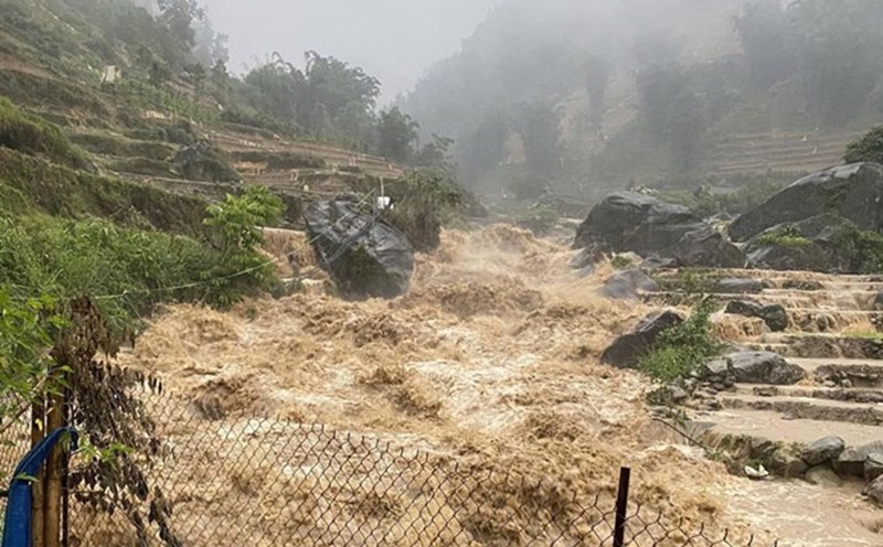
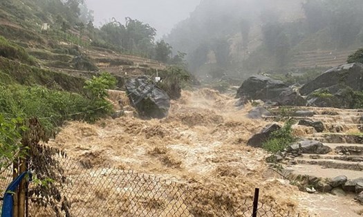
Night of August 17 and August 18: the Gulf of Tonkin, the sea area from South Quang Tri to Ca Mau, Ca Mau to An Giang, the Gulf of Thailand and most of the East Sea (including Hoang Sa, Truong Sa) will have showers and thunderstorms; during thunderstorms, there is a possibility of tornadoes, strong gusts of wind, waves over 3.5m high.
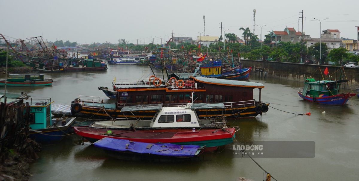
People and tourists should minimize travel, sightseeing or playing on the sea and islands during the tropical depression.
Closely monitor weather forecasts, warnings from the National Center for Hydro-Meteorological Forecasting and recommendations from local authorities to promptly adjust tourism plans.
If you are in coastal areas such as Quang Ninh, Hai Phong, Ninh Binh, Thanh Hoa, etc., visitors should avoid the beach area when there are warnings of big waves and strong winds.