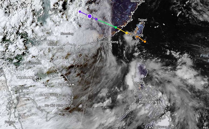
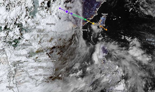
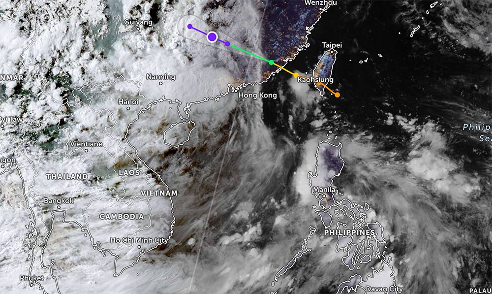
Typhoon Podul has weakened into a low pressure area in the Hebei region of Guangxi Zhuang Autonomous Region, China - more than 400km from Cao Bang. The circulation of Typhoon Podul is causing widespread heavy rain.
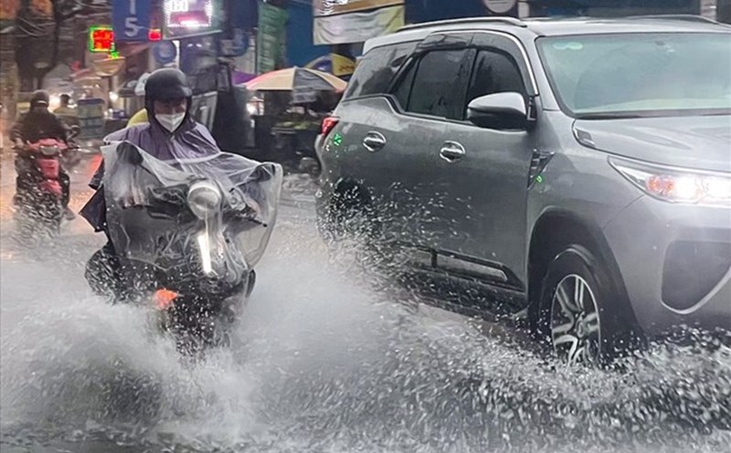
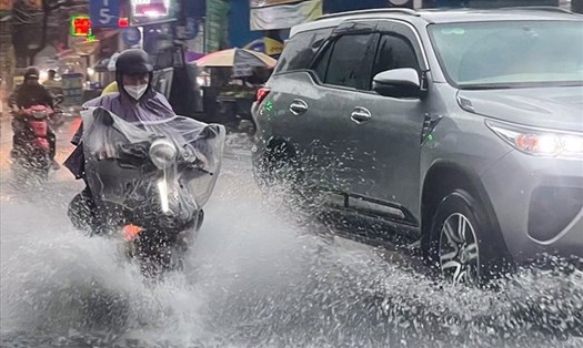
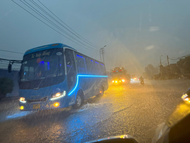
According to the rain forecast from the National Center for Hydro-Meteorological Forecasting, last night and early this morning (8.15), the Northern and Central Highlands regions had rain, moderate rain and thunderstorms, locally heavy to very heavy rain.
Weather forecast from the morning of August 15 to the night of August 16, the Northeast, Thanh Hoa and Nghe An will have moderate rain, heavy rain and thunderstorms, common rainfall of 70-150mm, locally very heavy rain over 300mm.
Weather forecast from the afternoon of August 15 to the night of August 16, the Central and Southern Plateau will have moderate rain, heavy rain and thunderstorms, common rainfall of 50-100mm, locally very heavy rain over 200mm.
In the afternoon and night of August 15, the Northwest, the area from Ha Tinh to Da Nang and the East of the provinces from Quang Ngai to Dak Lak will have scattered showers and thunderstorms, locally heavy to very heavy rain with rainfall of 15-30mm, locally over 100mm.
The eastern area of Khanh Hoa and Lam Dong will have rain, moderate rain and scattered thunderstorms, locally heavy rain to very heavy rain with rainfall from 20-40mm, locally over 100mm.
Warning of the risk of heavy rain over 100mm/3 hours.
During thunderstorms, there is a possibility of tornadoes, lightning, hail and strong gusts of wind.
From August 17 to the night of August 18, the Northeast and the area from Thanh Hoa to Quang Tri will have moderate rain, heavy rain and thunderstorms; locally very heavy rain with common rainfall of 50-120mm, locally over 300mm.
Disaster risk warning level: Level 1. People and tourists in the above areas need to be on guard against heavy rain, accompanied by thunderstorms, lightning, and hail.
Prevent the risk of flash floods, landslides, and land subsidence on steep slopes and small streams in the provinces of Lai Chau, Dien Bien, Lao Cai, Tuyen Quang, Thai Nguyen, Cao Bang, Lang Son, Quang Ninh, and Hai Phong.
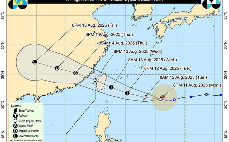
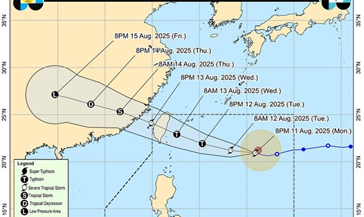
At sea, a low pressure area formed in the Central East Sea area, at 07:00 on August 15 at about 13.5-14.5°N; 113.5-124.5°E.
The low pressure area in the Central East Sea will move slowly in the North-Northwest direction and is likely to strengthen into a tropical depression.
Day and night on August 15, in the Gulf of Tonkin, the sea area from South Quang Tri to Ca Mau, Ca Mau to An Giang, the Gulf of Thailand, the North, Central and South East Sea (including the special areas of Hoang Sa and Truong Sa) will have scattered showers and thunderstorms. During thunderstorms, there is a possibility of tornadoes, strong gusts of wind and waves 2.0-3.0m high.