According to storm news, the latest low pressure from the National Center for Hydro-Meteorological Forecasting, the tropical depression is strengthening in the East Sea.
As of 1 pm today, July 1, the center of the tropical depression is located at about 14.6 degrees North latitude - 117.4 degrees East longitude, over the northeast sea area of the Central East Sea. The strongest wind near the center of the low pressure reaches level 6 (39-49km/h), gusting to level 8. The low pressure is moving in the West-Northwest direction at a speed of 15-20km/h.
It is forecasted that by 1:00 PM on July 2nd, the low pressure will move to the southern sea area of the Northern East Sea, about 290km east-southeast of the Hoang Sa special zone and is likely to strengthen into a storm, intensity level 8, gusts level 10.
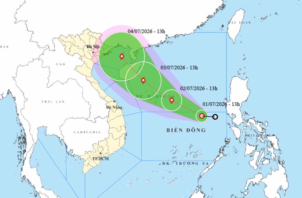
By 13:00 on July 3, this system continued to move in the Northwest direction, to the sea area southeast of Hainan Island (China), with the possibility of strengthening to level 8-9, gusting level 12.
In the next 48-72 hours, the storm is likely to continue moving in a Northwest direction at a speed of about 15km/h.
Due to the influence of the low pressure, the sea area east of the North and Central East Sea (including the Hoang Sa special zone) has strong winds of level 6, then increasing to level 7, gusts of level 9-10. Sea waves are 2-3m high, especially in the area near the low pressure center, waves are 3-4m high, the sea is rough.
The meteorological agency warns that ships operating in dangerous areas are at risk of being affected by thunderstorms, tornadoes, strong winds and large waves.
People and tourists planning to go to sea or operate in the Northern and Central East Sea areas need to regularly update on the developments of the low pressure. Follow the instructions of functional agencies, limit going to sea when the weather is bad to ensure safety.


