According to the latest low pressure forecast from the Philippine Atmospheric, Geophysical and Astronomical Services Administration ( pagasa), the low pressure is operating in the Philippine Area of Responsibility (PAR).
This low pressure has a moderate probability of strengthening into a tropical depression in the next few days.
At 5:00 a.m. on June 24 (local time), the low pressure was determined to be located about 290 km west of Tanauan City, Batangas Province.
The possibility of typhoon formation in the next 24 hours is low, but the possibility of strengthening in the following days cannot be ruled out, according to meteorologist Chenel Dominguez.
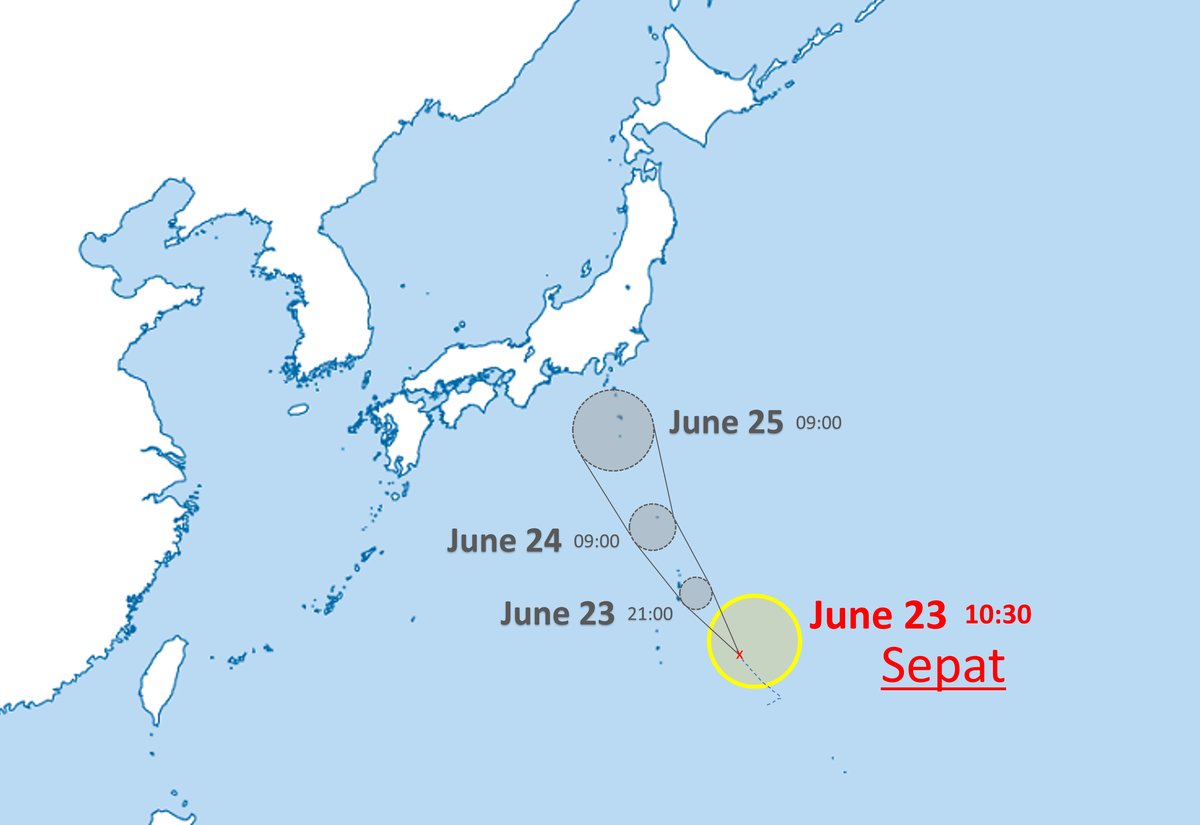
Meanwhile, Typhoon No. 2 SEPAT is moving towards the Southeast coast of Japan, with winds of about 65km/h.
The storm was formed from a tropical depression in the Philippine Sea. According to the Japan Meteorological Agency's forecast, on June 25, after reaching the mainland, the storm will gradually weaken.
According to the National Center for Hydro-Meteorological Forecasting, on June 24, a low pressure trough with an axis over the Central East Sea caused widespread thunderstorms.
On Phu Quy island, there are southwest winds of level 5, sometimes level 6.
Weather forecast for the day and night of June 24, the eastern sea area of the North East Sea, the central and southern East Sea (including the Truong Sa archipelago), the sea area from Binh Thuan to Ca Mau, Ca Mau to Kien Giang and the Gulf of Thailand will have showers and thunderstorms.
During thunderstorms, beware of tornadoes, strong gusts of wind of level 6-7, waves over 2m high.
Due to the influence of low pressure, visitors should limit going out to sea, postpone island tours or sea sports during thunderstorms.
Always monitor updated weather reports from authorities, especially if you are planning to travel by boat or stay on islands in the waters from Binh Thuan to Ca Mau, from Ca Mau to Kien Giang, and the Gulf of Thailand.


