According to the latest weather forecast from the Philippine Atmospheric, Geophysical and Astronomical Services Administration (PAGASA), a tropical depression strengthened into a storm on the morning of June 23.
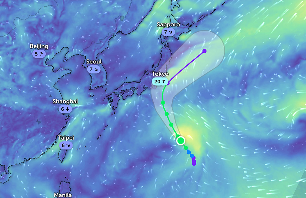
The tropical storm is called SEPAT. As of 8:00 a.m. on June 23, the center of the storm was at about 24.5 degrees North latitude - 144.7 degrees East longitude.
The strongest wind speed near the center of storm SEPAT reached 65km/h, gusting up to 80km/h. The storm is moving northwest at a speed of 15km/h.
According to Zoom Earth, Typhoon Sepat may strengthen slightly as it moves north-northwest towards the sea near Tokyo, Japan in the next few days.
People and tourists in the Philippines and Japan should pay attention to weather forecasts and proactively avoid risks due to heavy rain or thunderstorms.
PAGASA forecasts that in addition to Typhoon SEPAT, in the last week of June, a new low pressure will form in the East, outside the PAR. However, the low pressure is unlikely to develop into a tropical depression.
According to the National Center for Hydro-Meteorological Forecasting, as of 10:00 a.m. on June 23, the East of the Central East Sea and the Gulf of Thailand had scattered showers and thunderstorms.
It is forecasted that during the day and night of June 23, the Central and South East Sea (including the Truong Sa archipelago), the sea from Binh Thuan to Ca Mau, Ca Mau to Kien Giang and the Gulf of Thailand will have showers and thunderstorms.
The sea area from Binh Thuan to Ca Mau has strong southwest winds of level 5, sometimes level 6, gusting to level 7; waves from 1.5-2.5m high, rough seas.
During thunderstorms, there is a possibility of tornadoes, strong gusts of wind of level 6-7 and waves over 2.0m high. Ships operating in the above areas need to pay special attention to the risk of tornadoes, strong gusts of wind and large waves causing unsafety.
Therefore, people and tourists planning to visit the coastal areas of the above areas should pay attention to weather forecasts and follow local recommendations to ensure safety throughout the journey.


