According to the latest weather forecast from the Philippine Atmospheric, Geophysical and Astronomical Services Administration (PAGASA), the low pressure area outside the Philippine Area of Responsibility (PAR) strengthened into a tropical depression in the early morning of June 23.
As of 2:00 a.m. on June 23, the center of the tropical depression was at about 23.8 degrees North latitude - 145.3 degrees East longitude, 2,435 km east-northeast of the northernmost point of Luzon.
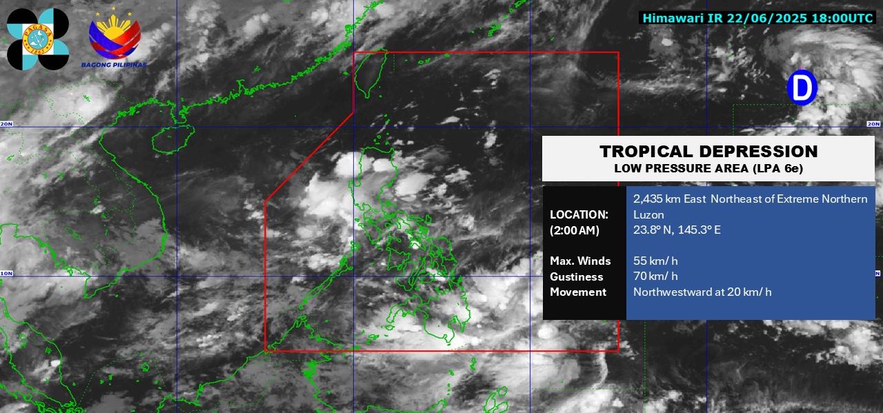
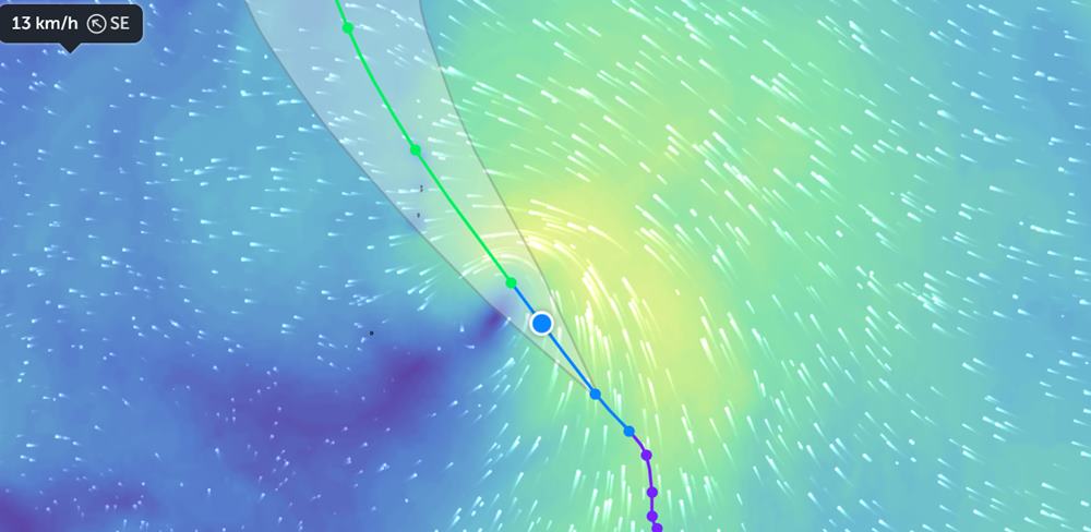
The strongest wind speed near the center of the tropical depression reached 55km/h, gusting up to 70km/h. The tropical depression is moving northwest at a speed of 20km/h.
According to Zoom Earth, the tropical depression is likely to strengthen into a storm in the next 24 hours, heading towards the sea near Tokyo, Japan.
moderate to heavy rain can cause floods and landslides.
People and tourists in the Philippines and Japan should pay attention to weather forecasts and proactively avoid risks caused by heavy rain or thunderstorms.
According to the National Center for Hydro-Meteorological Forecasting, the Gulf of Tonkin sea area will have scattered showers and thunderstorms, with a long view of over 10km. Male wind level 3-4, waves 1-2.5m high.
The sea area from Binh Thuan to Kien Giang will have scattered showers and thunderstorms. During thunderstorms, there is a possibility of tornadoes and strong gusts of wind of level 6-7.
A view of over 10km away, reduced to 4-10km in rain. Southwest wind level 4-5, sometimes level 6, gust level 7, rough seas. Waves are 2.0 - 3.0m high.
The central and southern East Sea will have scattered showers and thunderstorms. During thunderstorms, there is a possibility of tornadoes and strong gusts of wind of level 6-7. A view of over 10km away, reduced to 4-10km in rain. Southwest to male winds at level 3-4. Waves are 1.5 - 2.5m high.
People and tourists who want to travel by sea should pay attention to weather forecasts and be on guard against thunderstorms with strong gusts of wind and rough seas.


