According to storm news, the latest low pressure from the Joint Typhoon Warning Center (JTWC), Typhoon Narella and a low pressure area are operating in the Pacific Ocean.
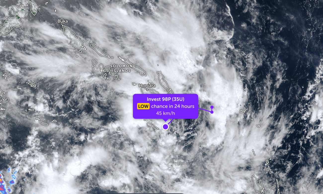
As of the morning of March 21, the low pressure bearing the symbol Invest 98P has just passed through an island in the southern Solomon Islands area. The strongest wind near the center of the low pressure reached 35 km/h. The low pressure is forecast to have little chance of developing into a tropical depression in the next 24 hours.
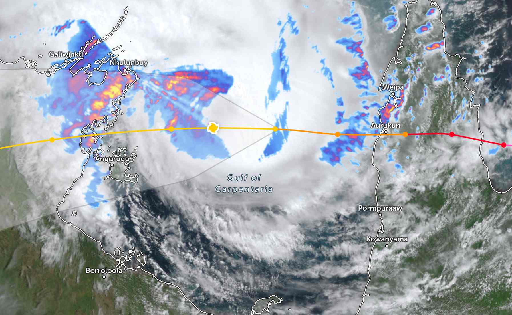
Meanwhile, Super Typhoon Narella continues to operate strongly at sea. Yesterday (March 20), the super typhoon made landfall on the coast of Queensland with level 4 gusts, then moved west through Carpentaria Bay.
Currently, the storm has reduced its intensity to a hurricane. The strongest wind near the center of the storm reaches 120 km/h, gusting up to 130 km/h. According to senior meteorologist Angus Hines, the storm is expected to strengthen to level 3 again around 12:21 pm (local time), as it approaches Northern Australian Territory.
The storm will pass through the north of Groote Eylandt Island at around 10 pm (local time), making landfall at around 3-4 am tomorrow.
The eye of the storm is expected to bring strong gusts of wind causing damage and widespread heavy rain. Tropical storm warnings are still in effect from Nhulunbuy to Borroloola.
In the past 48 hours, the largest rainfall was concentrated in the central areas of the peninsula. Rainfall recorded at Full Creek on the Pascoe River was 422mm, Portland Road on the Wenlock River received 408mm, and Weipa on the west coast of the peninsula recorded 283mm.
According to the Australian Meteorological Administration, weather conditions in Queensland are gradually improving as the weather system moves out of the west coast of the peninsula, and authorities are beginning to assess damage.
This weekend, Northern Territory is forecast to have strong winds causing damage at the center of the storm, accompanied by rainfall from 100 to 200mm over a wide area. The wind is forecast to gradually decrease on Sunday, while the rain will continue.
Heavy rain could cause widespread flooding, including around Katherine and the Katherine River, Beswick and the Waterhouse River, and the communities of Daly River and Nauiyu.
Tourists planning to travel to Northern Australia during this time should pay attention to weather forecasts. Regularly check flight schedules and follow local instructions to avoid storms affecting the journey.


