
According to the Joint Typhoon Warning Center (JTWC), the center of Typhoon Ba Vi is currently about 876 km south of Kadena Air Base. In the past 6 hours, the typhoon has moved in a Northwest direction at a speed of about 19 km/h.
The strongest wind near the storm center reaches 205 km/h, at the level of a very strong typhoon. The maximum sea waves caused by the storm are up to 15.2 m.
JTWC assesses that Typhoon Ba Vi will continue to move in a Northwest direction under the impact of subtropical high pressure. It is forecasted that in the next 36 hours, the typhoon will approach Ishigakijima Island (Japan), then move through the sea area between Taiwan (China) and the Ryukyu Islands before making landfall in the mainland of eastern China after about 48 hours.
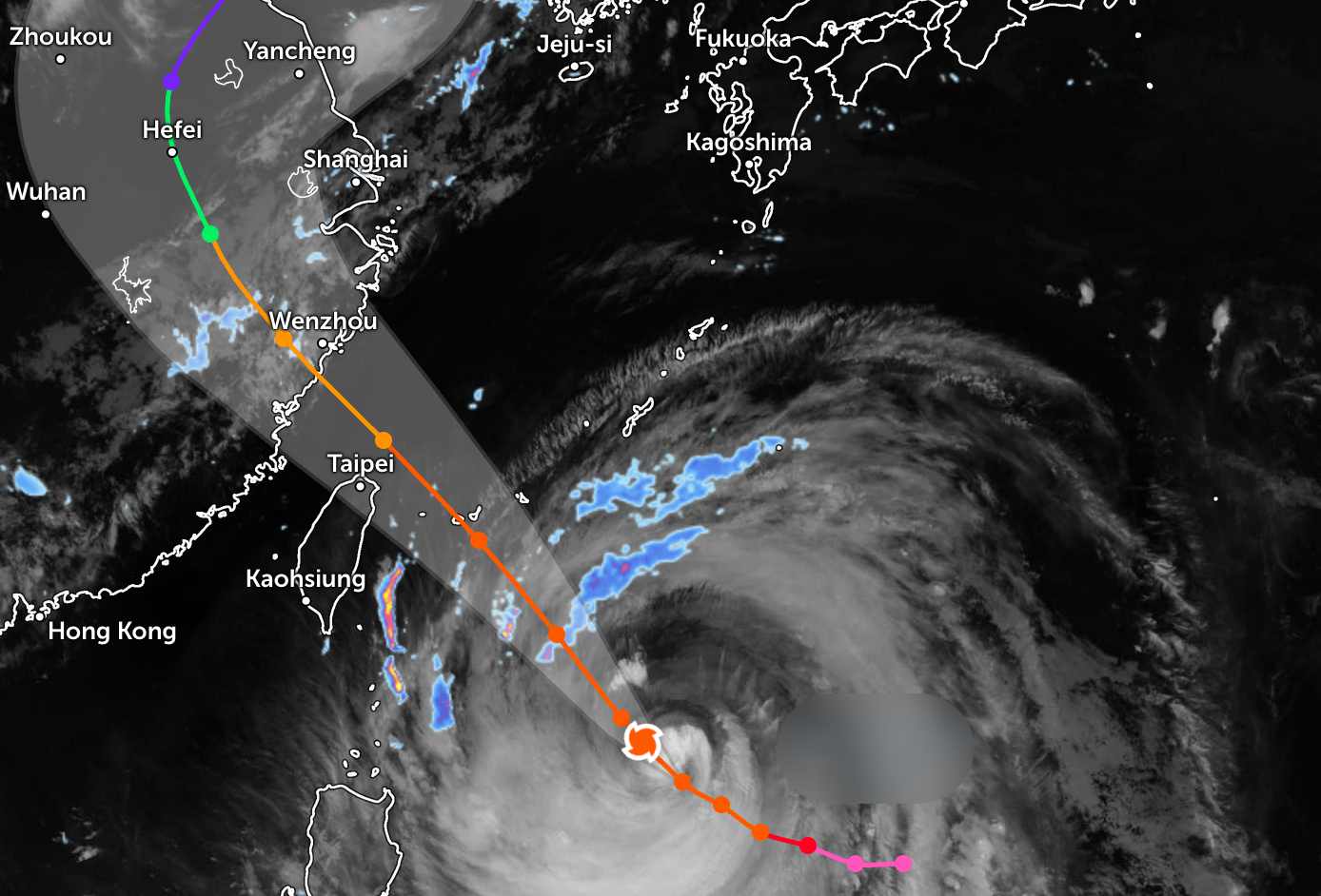
After entering the mainland, the storm's circulation will shift to the North and then Northeast and weaken rapidly.
Regarding intensity, JTWC said that the strength of Typhoon Ba Vi may fluctuate in a short time. In the next 12 hours, the typhoon is likely to weaken slightly, then remain or strengthen slightly.
However, from about 24 hours, conditions at sea will no longer be favorable for the storm to develop. It is forecast that the storm will weaken significantly from about 36 hours and continue to rapidly decrease in intensity after making landfall in mainland China.
JTWC also forecasts that the strong wind area of the storm will expand over the area from Taiwan (China) to Okinawa (Japan), causing dangerous weather in the wide sea area before the storm makes landfall.
In the East Sea, according to the National Center for Hydro-Meteorological Forecasting, on the night of July 9th and July 10th, the sea area from Khanh Hoa to Vinh Long, the south of the Central East Sea area and the South East Sea area (including Truong Sa special zone) will have southwest wind level 6, gusts level 7-8, rough seas, waves 2-3 m high. From the afternoon of July 10th, the northeast of the East Sea will gradually strengthen to level 6, gusts level 7-8, rough seas, waves 2-4 m high.
Also during this time, the Northern Gulf of Tonkin, the sea area from Lam Dong to Ca Mau, Ca Mau to An Giang, the Gulf of Thailand, the East of the Central East Sea and the South East Sea area (including Truong Sa special zone) will have scattered showers and thunderstorms. In thunderstorms, there is a possibility of tornadoes and strong gusts of wind.
People and tourists planning to travel to Taiwan (China), Okinawa (Japan) or eastern China during this time should closely monitor weather developments. Regularly check flight schedules and follow local instructions to avoid dangerous storms throughout the journey.


