
According to the National Center for Hydro-Meteorological Forecasting, during the day and night of July 9, many sea areas continue to be affected by strong southwest monsoon combined with the distant circulation of super typhoon Bavi, causing rough seas, large waves and thunderstorms in many areas.
Specifically, the sea area from Khanh Hoa to Vinh Long, south of the Central East Sea area and the South East Sea area (including Truong Sa special zone) has strong southwest winds at level 6, gusts at level 7-8; rough seas, waves 2-3m high.
In addition, the Northern Gulf of Tonkin, the sea area from Lam Dong to Ca Mau, Ca Mau to An Giang, the Gulf of Thailand, the East of the East Sea and South East Sea (including Truong Sa special zone) have scattered showers and thunderstorms. In thunderstorms, there is a risk of tornadoes, strong gusts of wind, affecting the operation of ships at sea.
The sea continues to be rough on July 10.
Forecast for the day and night of July 10, the sea area from Khanh Hoa to Ca Mau, the Central and Southern East Sea area (including Truong Sa special zone) will continue to have Southwest wind level 6, gusts level 7-8, waves 2-3m high, rough seas.
Notably, from the afternoon and night of July 10, the eastern part of the Northern East Sea area has strong winds of level 6, sometimes level 7, gusts of level 8-9; sea waves are 2-4m high, strong rough seas.
According to the 10-day sea wave forecast, from July 9th to July 11th, many areas continue to record high waves:
- Sea area from South Quang Tri to Quang Ngai and Hoang Sa special zone: waves 1.5-2.5m high.
- Sea area from Gia Lai to Ca Mau, South East Sea and Truong Sa special zone: waves 2-3m high.
- North East Sea: waves 3-5m high, especially the eastern area 4-6m.
- In the East Sea: waves 2-4m high.
The level of natural disaster risk due to strong winds at sea is maintained at level 2.
Tourists need to proactively follow the train schedule before the trip.
Although super typhoon Bavi is unlikely to enter the East Sea, the typhoon's circulation still contributes to increasing strong winds and large waves in many sea areas, which may affect passenger transport and sea tourism activities, especially on ship routes to the islands.
Tourists planning to visit islands such as Co To, Cat Ba, Con Dao, Phu Quoc, Ly Son, Cu Lao Cham or high-speed cruise routes should proactively update weather information, contact transportation units to know the train schedule before departure. In rough seas conditions, many train trips may adjust the time or temporarily suspend operation to ensure safety.
For those participating in sea activities such as taking tourist boats, fishing, coral diving or rowing, it is necessary to strictly follow the instructions of functional forces and crew members, always wear life jackets, and limit going to distant sea areas when there is warning of strong winds, thunderstorms or big waves.
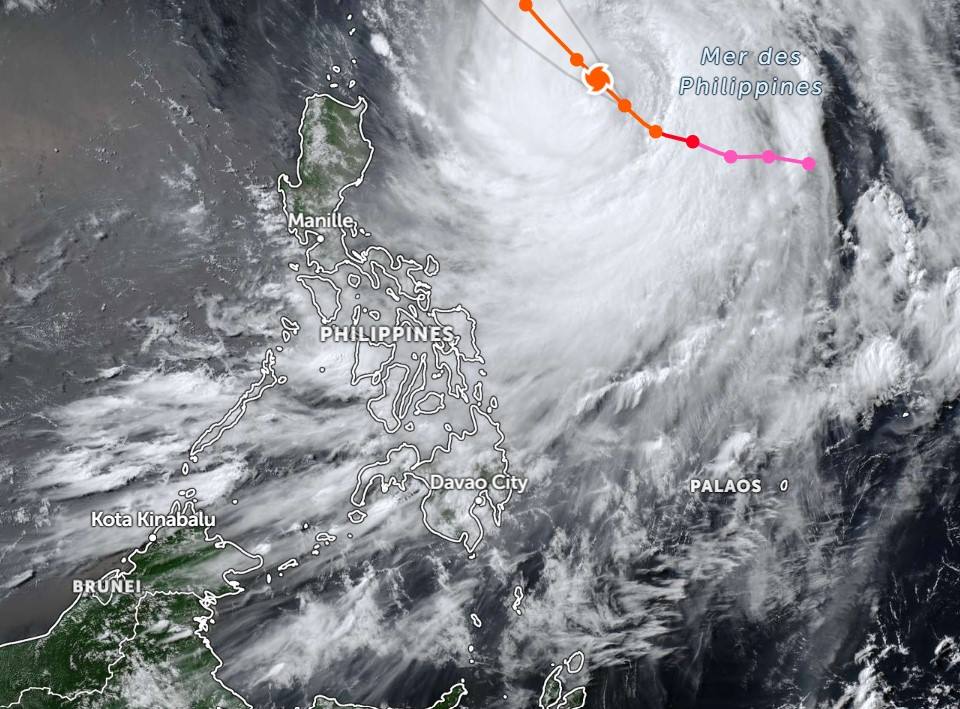
From July 9th, southwest winds in the southern area of the East Sea, including the waters of the Truong Sa archipelago, will gradually strengthen to level 6. On July 10th and 11th, the north, mid and southern areas of the East Sea, including the waters of the Hoang Sa and Truong Sa archipelagoes, may experience strong winds of level 6-7, sea waves 3-5m high, and very rough seas.
The meteorological agency also recommends that tourist ship owners, passenger ships and fishermen regularly monitor weather forecasts, be ready to adjust their routes or take their vehicles to safe shelters when weather conditions worsen.


