According to storm news, the latest low pressure of the Philippine Atmospheric, Geophysical and Astronomical Services Administration (PAGASA) storm Francisco is strengthening near the East Sea.
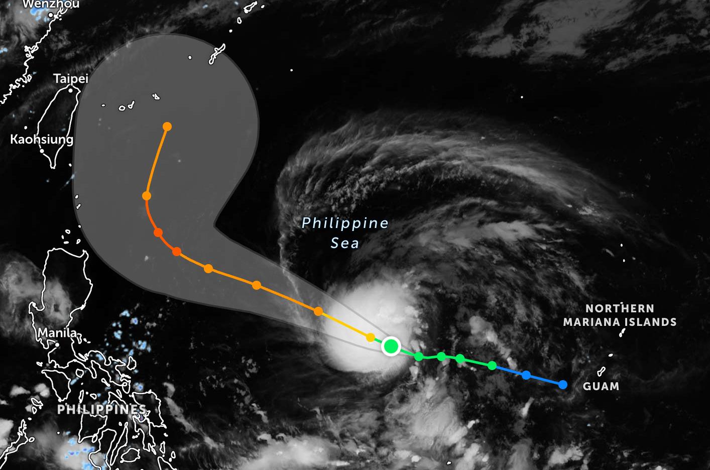
As of 4 pm on June 20, the center of Typhoon Francisco is located at 14.3 degrees North latitude - 136.4 degrees East longitude, about 1,480 km southeast of Luzon Island.
The storm maintains the strongest wind near the center reaching 85 km/h, gusting up to 105 km/h and is moving in a West direction at a speed of about 15 km/h, towards the East Sea.
The storm is forecast to continue to strengthen fiercely on its path and will reach typhoon level tomorrow morning, June 21.
PAGASA said that Typhoon Francisco's path is affecting the eastern areas of Visayas and Mindanao. Due to the impact of the typhoon's circulation, the eastern Visayas, Southern Leyte, Caraga and Davao regions have scattered showers and thunderstorms, cloudy skies. Moderate to heavy rain at times can cause floods and landslides in vulnerable areas.
Meanwhile, the Southwest monsoon continues to cause bad weather in the Zamboanga peninsula, Bangsamoro Autonomous Region (BARMM), SOCCSKSARGEN and Lanao del Norte province with scattered showers and thunderstorms. The risk of flooding and landslides is also warned in places with prolonged heavy rain.
In Metro Manila and many other areas of the Philippines, the weather is generally cloudy to mostly cloudy, accompanied by showers or localized thunderstorms due to local heat convection.
At sea, the Visayas area and eastern Mindanao have winds from Northeast to Northwest with light to moderate intensity, sea waves are 0.6-1.8 m high.
In Luzon, Northeast to Southeast winds operate with light to moderate intensity, sea waves are 0.6-1.2 m high. The rest of Mindanao has Southwest to West winds, sea waves are 0.6-1.2 m high.
According to PAGASA, Typhoon Francisco continues to be closely monitored as it moves over the Northwest Pacific Ocean. Although still far from the mainland Philippines and the South China Sea, the storm is tending to strengthen as it moves westward.
People and tourists planning to travel to the Philippines or areas with storms should pay attention to weather forecasts. Follow local instructions to avoid storms affecting your journey.


