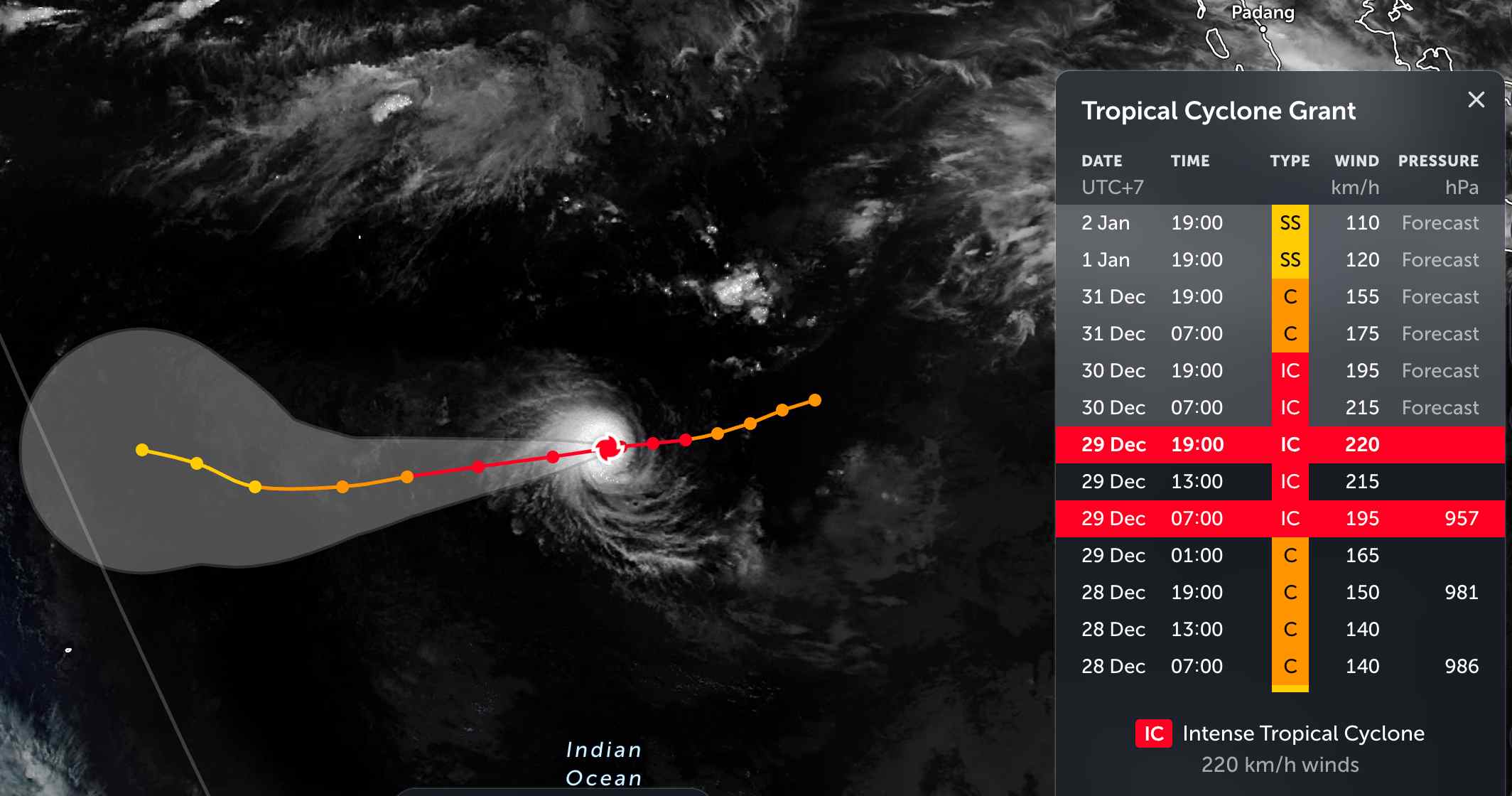
According to the latest storm news from the Joint Typhoon Warning Center (JTWC), Typhoon Grant has officially strengthened into a super typhoon in the Indian Ocean.
By 7:00 PM on December 29 (local time), the center of super typhoon Grant is 1,141 km southeast of Diego Garcia coral reef. In the past 6 hours, the typhoon has moved west at a speed of 19 km/h. The maximum wave height reached 10.7 m.
The strongest wind near the super typhoon center reaches 220 km/h. The typhoon is expected to continue to move in a westerly direction, maintaining winds above 200 km/h until December 30 before gradually weakening into a typhoon on the first day of the new year 2026.
Due to being quite far from the mainland, super typhoon Grant only caused heavy rain and big waves at sea.
Meanwhile, in the East Sea, according to the National Center for Hydro-Meteorological Forecasting, on the night of December 29 and the day of December 30, the sea area from Khanh Hoa to Ho Chi Minh City: Northeast wind level 5, sometimes level 6, gusts level 7-8. Sea rough. Sea waves 2.0-3.0m high.
The western sea area of the South East Sea (including the western sea area of Truong Sa special zone): Northeast wind level 6, gusts level 7-8; rough seas. Sea waves 2.0-4.0m high. The South East Sea area (including Truong Sa special zone) has scattered showers and thunderstorms.
On the night of December 30th and December 31st, the western sea area of the South China Sea (including the western sea area of Truong Sa special zone) will have strong Northeast winds at level 6, gusts at level 7-8; rough seas; waves 2.0-4.0m high.
All ships operating in the above areas are at high risk of being affected by strong winds and big waves.People and tourists should avoid going out to sea when there are big waves and strong seas to ensure safety.
Do not be subjective to bad weather warnings because winds may strengthen rapidly and change direction, and the sea is rough.


