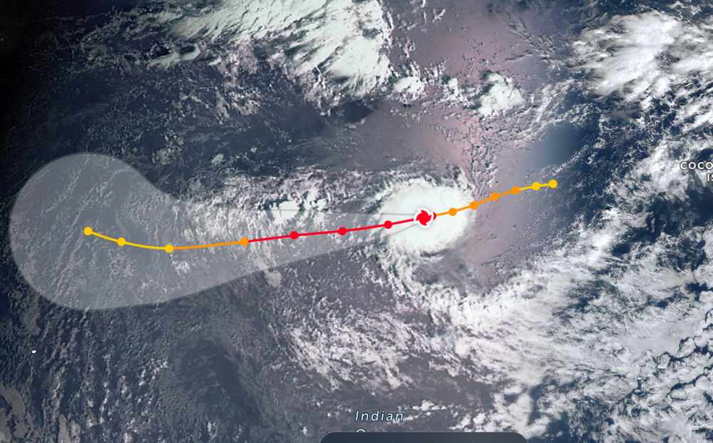
According to the latest storm news from the Joint Typhoon Warning Center (JTWC), on the morning of December 29, Typhoon Grant is continuing to strengthen in the Indian Ocean.
The center of the storm is located 1,304 km southeast of Diego Garcia. In the past 6 hours, the storm has moved westward at a speed of 19 km/h. The maximum wave height is 8.5 km.
The strongest wind near the storm center reaches 195 km/h. It is forecast that the storm will strengthen to super typhoon level tonight, December 29 (local time). The maximum wind reaches 215 km/h.
Due to being located quite far from the mainland, the current storm causes thunderstorms and large waves at sea.
Previously, Hurricane Grant had affected the Cocos and Christmas Islands.
In the East Sea, according to the National Center for Hydro-Meteorological Forecasting, today, December 29, the sea area from Khanh Hoa to Ho Chi Minh City and the western sea area of the South East Sea (including the western sea area of Truong Sa special zone): Northeast wind level 6, gusts level 7-8. Sea rough. Sea waves 2.0-4.0m high.
South East Sea area (including Truong Sa special zone): scattered showers and thunderstorms.In thunderstorms, there is a possibility of tornadoes and strong gusts of wind.
On the day and night of December 30, the sea area from Khanh Hoa to Ho Chi Minh City and the sea area west of the South East Sea area (including the sea area west of Truong Sa special zone): Northeast wind level 5, sometimes level 6, gusts level 7-8, rough seas, waves 2.0-4.0m high.Level of natural disaster risk at sea: level 2.
All ships operating in the above areas are at high risk of being affected by strong winds and big waves.
People and tourists who plan to visit these sea areas should pay attention to weather forecasts. Avoid going out to sea when the sea is rough and follow local instructions.
Proactively adjust outdoor tour schedules, check flight status, transportation, and update information from travel agencies.


