According to the latest storm news from the Joint Typhoon Warning Center, on the morning of February 24 (Vietnam time), Typhoon Horacio has strengthened to super typhoon level. The strongest wind near the center of the super typhoon has reached 260 km/h.
This is also the first Category 5 storm in 2026. Category 5 storms have gusts of over 249 km/h, extremely destructive power.
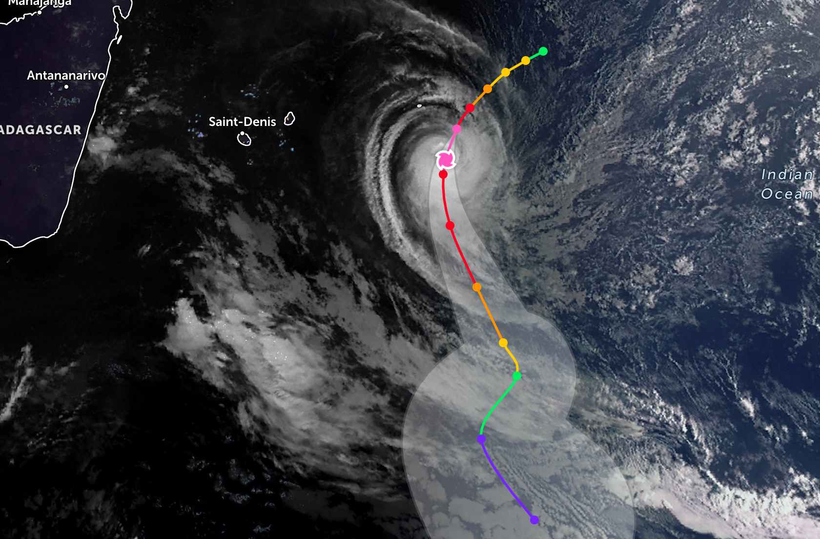
The center of super typhoon Horacio is located 815 km east of Port Louis port, Mauritius. In the past 6 hours, the super typhoon has moved in the South - Southwest direction at a speed of 20 km/h. The maximum wave height is 12.2 m.
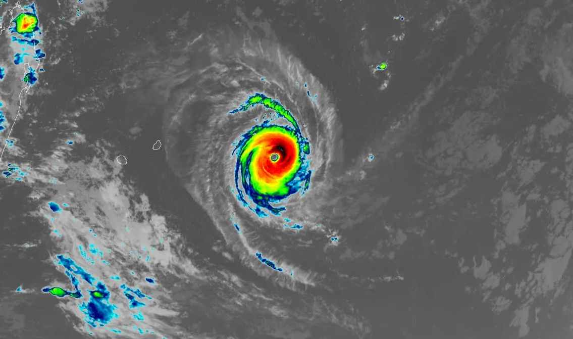
Forecast for the next 24 hours, the super typhoon will continue to move in a South direction, then change direction to Southeast. Wind force will maintain at 260 km/h until this afternoon, February 24th, and then gradually weaken.
Forecast for the next 3 days, the storm will continuously change in intensity, increasing and decreasing, until it weakens into a tropical depression on Saturday. Due to being far from the mainland, the super typhoon did not pose a danger to any mainland area during the forecast period.
Hurricane Horacio is also the first Category 5 hurricane in the Southern Hemisphere in 2026. Previously, super typhoon Errol reached this level off the coast of Northern Australia on April 16, 2025. The average annual number of Category 5 storms globally from 1990 to 2025 was 5.3.
2025 has five Category 5 super typhoons (Melissa, Erin and Humberto in the Atlantic; Ragasa in the Northwest Pacific; and Errol in the South Indian Ocean). Climate change is predicted to increase the rate of tropical storms reaching Category 4 and 5 intensity in the near future.
People and tourists planning to fly or travel by boat through the storm-stricken sea area in the Indian Ocean should pay attention to checking their itinerary, safety recommendations from local authorities and the latest weather forecast.


