
According to storm and low pressure news from the Philippine Atmospheric, Geophysical and Astronomical Services Administration (PAGASA), Typhoon Jangmi is strengthening near the East Sea.
As of 8 pm tonight (local time), the storm's center is located at about 10.6 degrees North latitude - 137.1 degrees East longitude, about 1,240 km northeast of Mindanao. The storm is slowing down and moving in a Northwest direction at a speed of 15 km/h, heading towards the East Sea.
The strongest wind near the storm center reached 75 km/h, gusting up to 90 km/h. Strong winds extended outside the storm center up to 380 km. The storm is expected to continue to strengthen fiercely, with wind speeds exceeding 100 km/h by the end of this week.
Typhoon Jangmi and the impact of the Southwest monsoon are causing bad weather in many areas of the Philippines.
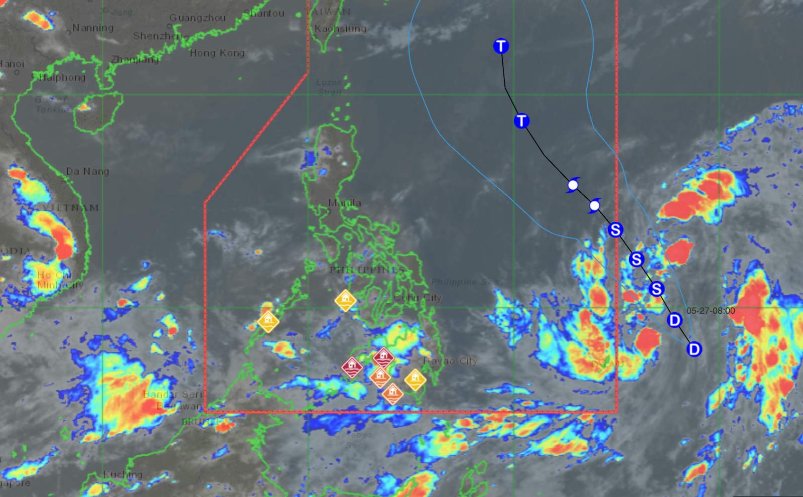
The meteorological agency forecasts that the Zamboanga, BARMM, Lanao del Norte, Misamis Occidental, South Cotabato, Sultan Kudarat, Sarangani and Palawan peninsulas will have scattered showers and thunderstorms, with cloudy skies. Moderate to heavy rain at times can cause flooding and landslides in low-lying and mountainous areas.
Meanwhile, Davao Oriental and Davao de Oro are directly affected by the low pressure trough of tropical storm Jangmi, so widespread showers and thunderstorms continue to appear. The risk of flash floods and landslides is warned in places with prolonged heavy rain.
In Metro Manila and many other areas of the Philippines, the weather is generally cloudy, with showers and localized thunderstorms due to the influence of local heat convection. Some places may experience heavy rain for a short time in the late afternoon and night, posing a risk of flooding.
Regarding sea conditions, the eastern region of Visayas and Mindanao has Northwest to West winds with light to moderate intensity, sea waves from 0.6-1.8 m high. The southwest Luzon area along with the rest of Visayas and Mindanao has Southwest to West winds, waves 0.6-1.5 m high. The remaining sea areas have light to moderate winds, light rough seas with waves from 0.6-1.2 m high.
In the East Sea, according to the National Center for Hydro-Meteorological Forecasting, on the night of May 27 and May 28, the South East Sea area (including the Truong Sa special zone), the sea area from Lam Dong to Ca Mau will have scattered showers and thunderstorms. In thunderstorms, there is a possibility of tornadoes, strong gusts of wind at level 6-7 and waves over 2.0m high.
People and tourists closely monitor weather forecasts, limit travel to areas at risk of flooding, landslides or coastal areas with strong waves.
Ships operating at sea need to be cautious in the face of bad weather conditions and storms that may occur unexpectedly.


