According to storm news, the latest low pressure from the Joint Typhoon Warning Center (JTWC), two low pressures are operating in the Pacific Ocean.
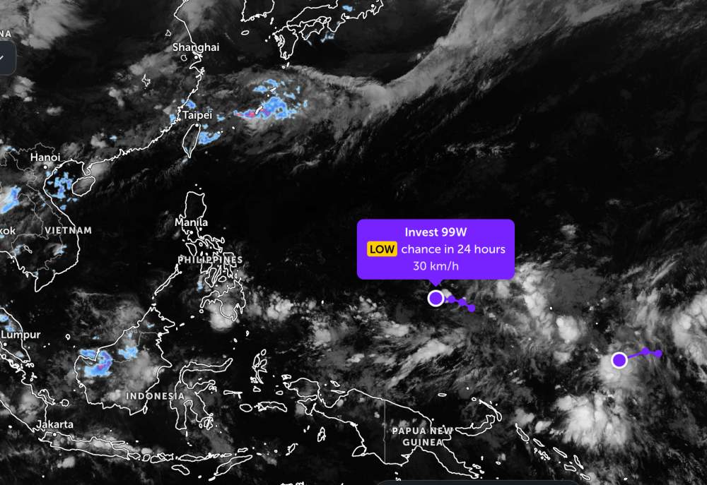
In which, the low pressure bearing the symbol Invest 99W is currently located in the south of Guam Island, in the western Pacific Ocean. The strongest wind near the center of the low pressure reaches 30 km/h.
The low pressure moves in a West-Northwest direction, towards the Philippine area of responsibility. JTWC forecasts that the low pressure is unlikely to develop strongly into a tropical depression or storm in the next 24 hours.
The remaining low pressure bearing the symbol Invest 90W is currently located near Nauru Island in the Western Pacific. The strongest wind near the center of the low pressure reaches 30 km/h.
The low pressure moves in a West - Southwest direction and is forecast to have little chance of strengthening into a tropical depression or storm in the next 24 hours.
Because it is still quite far from the mainland, the two low pressures only cause thunderstorms at sea, not affecting much the mainland areas around the area.
In the sea area of Vietnam, according to the National Center for Hydro-Meteorological Forecasting, most sea areas across the country have showers and thunderstorms in some places, visibility is commonly over 10km. The area of the Northern Gulf has south to southwest winds of level 4-5, sea waves 1.5-2.5m high; South of the Gulf of Tonkin wind level 4, waves 1-2m high.
In the East Sea, the Northern East Sea area and the Hoang Sa sea area have no rain, South to Southwest wind level 4, waves commonly 0.5-2m high. The central and southern East Sea area, Truong Sa special zone has showers and thunderstorms in some places, the sea is relatively calm.
Meanwhile, the sea area from Ca Mau to An Giang and the Gulf of Thailand has scattered showers, with strong thunderstorms in some places accompanied by the risk of tornadoes and strong gusts of wind. Visibility in the rain reduced to 4-10km.
People and tourists planning to visit these sea areas should pay attention to weather forecasts. Avoid going out to sea when the sea is rough and follow local instructions to ensure safety when traveling to the sea.