According to storm news, the latest low pressure from the Joint Typhoon Warning Center (JTWC), two new low pressures have just formed in the Pacific Ocean.
The first low pressure bearing the symbol Invest 99W is currently located in the Western Pacific, outside the Philippine area of responsibility. The strongest wind near the low pressure center reaches 30 km/h.
The low pressure moves northwest, towards the Philippine Sea. This weather system is forecast to have little chance of developing strongly into a tropical depression or storm in the next 24 hours.
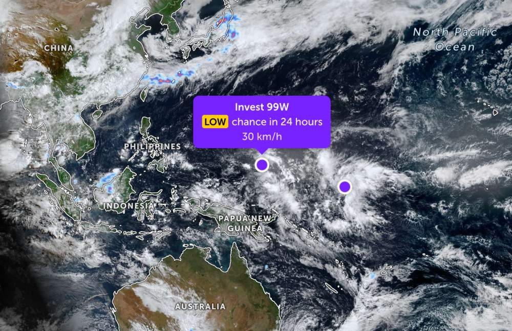
Not far away, the low pressure bearing the symbol Invest 90W is also located in the Western Pacific with the strongest wind reaching 30 km/h. The low pressure is forecast to have little chance of strengthening into a tropical depression or storm in the next 24 hours.
Because it is still quite far from the mainland, the two low pressures only cause thunderstorms at sea, with little impact on the mainland areas around the area.
In the East Sea, according to the National Center for Hydro-Meteorological Forecasting, from May to July 2026, the activity of storms and tropical depressions in the East Sea and direct impact on land is likely to be higher than the multi-year average.
According to climate statistics, during this period, on average, about 3.2 storms or tropical depressions appear in the East Sea, of which about 1.2 storms directly affect Vietnam's mainland.
Meanwhile, the period from August to October 2026 is forecast to have a lower number of storms and tropical depressions than the multi-year average. According to statistics, on average for many years during this period, there are about 6.8 storms operating in the East Sea, of which about 2.8 storms affect land.
The meteorological agency also especially noted the risk of the appearance of strong, even very strong storms, rapidly intensifying with complex trajectories and operating times, difficult to forecast in the context of climate change making the weather increasingly extreme.
Phenomena such as localized heavy rain, flash floods, and landslides are still at risk even when the number of storms in the season is not too large.
People and tourists planning sea tourism should regularly monitor weather forecasts, especially in coastal areas of the Central region and the East Sea, to proactively adjust their schedules, limit travel when there are thunderstorms, strong winds or dangerous weather warnings at sea.