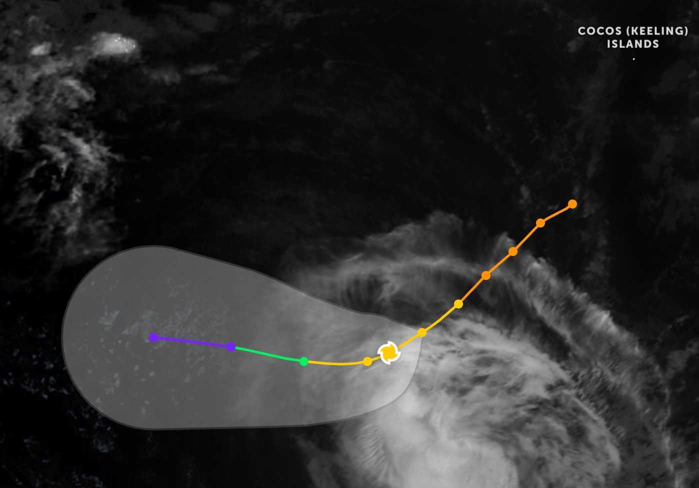
According to the latest storm news from the Joint Typhoon Warning Center (JTWC), on the evening of January 7, Typhoon Jenna was located about 819 km southwest of the Cocos Islands (Australia). In the past 6 hours, the storm moved in a southwest direction at a speed of about 19 km/h.
The strongest wind near the storm center reached 110 km/h. The maximum wave height reached 7.6 m.
Forecast for the next 12 hours, Typhoon Jenna will continue to move in a Southwest direction, then turn west due to the influence of a low pressure range located in the Southwest. After that, the typhoon will move mainly in a West direction until it gradually weakens.
Then, Jenna is forecast to move mainly westward, following the northern edge of this high pressure range throughout the remainder of the forecast period. Environmental conditions are assessed to be increasingly adverse, with increased northwest winds and the intrusion of dry air, causing Hurricane Jenna to gradually weaken throughout the forecast period.
The Indonesian Meteorological, Climate and Geophysical Agency (BMKG) has issued an early warning about the possibility of large waves in some Indonesian waters between January 7 and 10 due to the impact of Typhoon Jenna on January 7 to 10, 2026.
BMKG forecaster Amryuda Mas Nalendra said that tropical storm Jenna in the Southwest Indian Ocean and tropical depression 90W in the Philippine Sea have increased wind speed and wave height in Indonesian waters.
Mr. Amryuda warned that storms and tropical depressions could cause waves of 1.25–2.5 m high in many sea areas such as Southwest Morotai, West Halmahera, Obi, Sanana, Taliabu, Kayoa, Loloda Islands, Batang Dua and Ternate.
Areas off the coast of South and East Indonesia, including South West Java, South Yogyakarta, South and East Java, South Bali, South Central Java, South NTB, North Karimata Strait and Central Arafura Sea, may have higher waves, from 2.5-4 m.
The waves are very high, reaching 4.0 to 6.0 m, and are likely to appear in the North Natuna Sea," Mr. Amryuda said, while emphasizing that the risk of high waves in these areas may affect maritime safety.
Visitors to these sea areas during the time Hurricane Jenna passes should also pay attention to weather forecasts. Avoid going out to sea when the sea is rough and follow local instructions to ensure safety.


