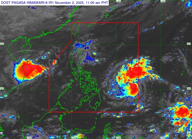
According to the latest typhoon information from the Joint Typhoon Warning Center (JTWC), typhoon Kalmaegi (Philippine name: Tino, typhoon No. 25 as Japanese calls it) is currently about 30,4 km north of Palau and moving west at a speed of about 24 km/h. Waves around the center of the storm are 5.5 m high.
Over the next two days, Typhoon Kalmaegi is forecast to continue moving westward due to the impact of the subtropical high pressure in the Northeast.
From the second to third day of the forecast cycle, another high pressure mass in the East Sea will strengthen and dominate the storm's movement.
Typhoon Kalmaegi is likely to gradually move northwest. This fund is likely to be maintained for the next 5 days.
Before making landfall in the Philippines, Kalmaegi passed through the sea very conveniently to increase the level.
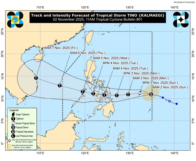
The JTWC forecasts the storm will rapidly intensify, from winds of about 85 km/h to about 175 km/h in just 2 days. After making landfall in the central Philippines, the storm will weaken due to interaction with the terrain, but will quickly strengthen again when it enters the East Sea.
Forecasts show that the storm may drop below 150 km/h as it passes through the Philippines.
However, when entering the East Sea, storm Kalmaegi is likely to reach a new peak in intensity, with winds reaching about 195 km/h in the next 4-5 days, when off the coast of Vietnam.
Forecast models currently have a fairly high consensus on the direction of the storm in the first 2 days, with the possibility of making landfall in the Philippines. The direction of movement will then have a greater dispersance, depending on the point of the storm inland.
However, models predict that Kalmaegi will turn northwest in the second half of the forecast period. The reliability of the forecast is high for the first 3 days, and the average is from the 3rd to the 5th day.
In terms of intensity, most models predict the storm will intensify very rapidly in the next 48 hours. After this period, there is a difference in the level of weakening of the storm when passing through the Philippines and the possibility of strengthening again in the East Sea.
models agree that the weakest storm will hit in about 60 hours, but the level of weakness may fluctuate quite largely.
The storm is forecast to reach its peak after about 4 days, but the strongest wind level may vary depending on the model.
Recommendations for tourists in the face of storm Kalmaegi
In the coming days, Typhoon Kalmaegi may cause rough seas on the sea route from the eastern Philippines to the East Sea.
Tourists traveling by boat, yacht or planning to visit coastal destinations in the central Philippines, Palawan or then the coast of Vietnam should closely monitor the updated news, as the situation can change rapidly as the storm develops.


