According to storm news, the latest low pressure from the Joint Typhoon Warning Center (JTWC), this morning March 25, Typhoon Narelle continued to strengthen fiercely when leaving the mainland, entering the Indian Ocean border area.
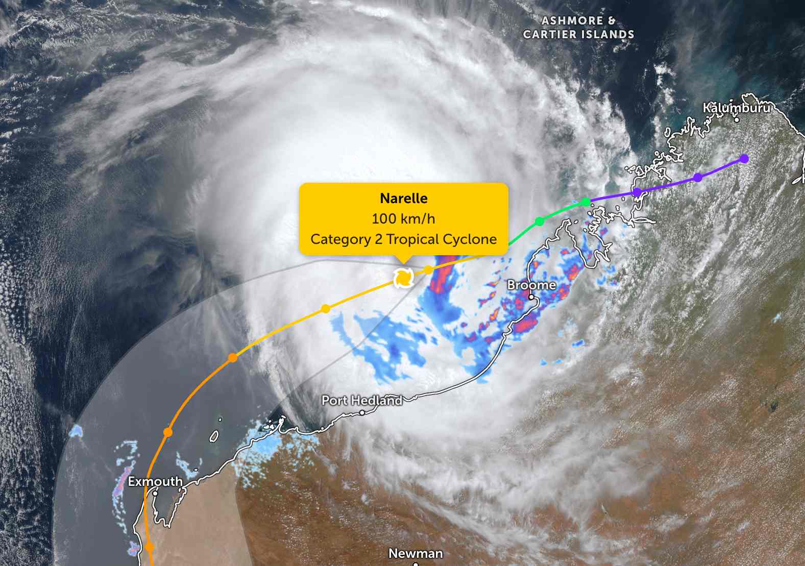
The storm's center is located 239 km northwest of Broome, Australia. In the past 6 hours, the storm has moved southwest at a speed of 28 km/h.
The strongest wind near the storm center reaches 100 km/h. The maximum wave height is 8.5 m.
JTWC forecasts that Typhoon Narelle will continue to strengthen rapidly and officially strengthen into a super typhoon this afternoon March 25, when wind speeds reach 130 km/h.
Wind speeds could rise to 185 km/h before entering the waters of western Australia and making landfall.
The Australian Bureau of Meteorology (BOM) forecasts that the Exmouth and Coral Bay areas may receive more than 100 mm of rain due to the impact of the storm.
The Department of Fire and Emergency Services (DFES) has delivered additional sandbags to Exmouth, Coral Bay, Carnarvon and Shark Bay.
Pilbara Ports, the world's largest port authority, has begun clearing docks in Ashburton, Cape Preston West, Dampier and Varanus Island - disrupting hundreds of millions of dollars worth of goods transiting through here every day.
People and tourists should not be subjective to the new developments of the storm. Tourists planning to visit Western Australia during this time should pay attention to weather forecasts. Check flight schedules, consider itinerary and follow local instructions to ensure safety.


