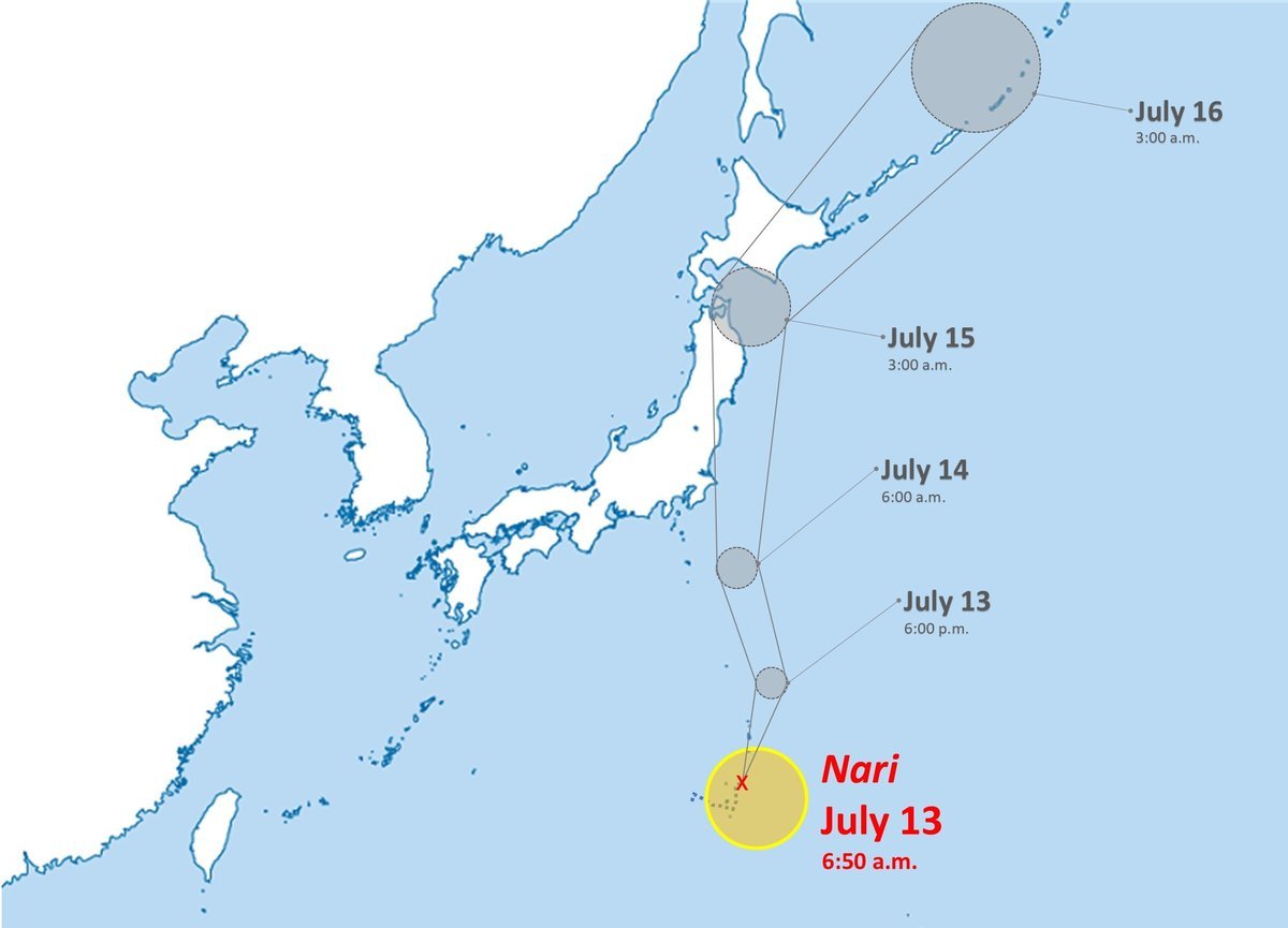
Hurricane Nari has been moving north at a rapid speed of about 56 km/h for the past 6 hours, according to the JWTC.
The waves in the storm's eye will reach a maximum altitude of about 6.1 meters.
Thuy Nari is forecast to reach its peak intensity of about 100 km/h in the next 12 hours.
It is forecasted that in the next 24 hours, storm Nari will continue to move rapidly north along the western edge of the subtropical high pressure.
The Japan Meteorological Agency (JMA) forecasts the storm will approach the Izu Islands, then the Kanto area, on July 14. The storm is also likely to approach the Tohoku region between Monday, July 14 and Tuesday, July 15.
Heavy rain and thunderstorms are forecast in the Ogasawara Islands, the Izu Islands, as well as many places in the Kanto region.
Most forecast models show the storm tending to move slightly eastward, located in the eastern sea of the Boso Peninsula, Japan.
The storm will then gradually weaken over the next 36 hours as it moves into colder waters.
Tourists planning to visit or stay in the southern and eastern coastal areas of Japan should pay special attention to the developments of Typhoon Nari.
According to the latest forecast, in the next 24 to 36 hours, the storm could strongly affect provinces such as Kagoshima, Miyazaki, Kochi, Tokushima, Wakayama, then expand its reach to the Kansai region (including Osaka, Kyoto), Chubu ( Shizuoka, Aichi) and the Kanto region, especially the provinces of Chiba, Kanagawa and Tokyo.
The Boso Peninsula (in Chiba Prefecture) is considered the area at most risk of being affected as the storm moves northeast and moves rapidly through this area.
Dangerous weather phenomena such as strong gusts of wind, heavy rain, localized flash floods and high waves may occur, causing disruption to road, railway and air traffic.
Tourists should avoid traveling by boat, ferry or fly to the above areas during the time of strong storm impact.
Contact your accommodation or travel agency to update information and adjust your schedule in a timely manner.

Storm Nari does not affect Vietnam's marine weather However, according to the National Center for Hydro-Meteorological Forecasting, on July 14, scattered showers and thunderstorms are likely to occur in the areas: Northern Gulf of Tonkin, the central and southern East Sea (including Truong Sa archipelago), the sea area from Lam Dong to Ca Mau, from Ca Mau to An Giang, and the Gulf of Thailand.
During thunderstorms, there is a possibility of tornadoes, strong gusts of wind and waves over 2.0 meters high.


