The Japan Meteorological Agency (JMA) said that tropical storm Nari is expected to enter the Kanto area (Japan) tomorrow morning (July 14).
This is the fifth storm to hit the Japanese sea this year.
As of 9:00 a.m. on July 13, the center of the storm was about 130 km south of Chichijima Island and was moving north at a speed of 15 km/h.
The storm is expected to continue to strengthen and move closer to Japan's Ogasawara Islands. The storm is likely to approach the Izu Islands and then the Kanto area tomorrow morning.
The storm is also expected to approach the Tohoku area from Monday (14.7) to Tuesday (15.7).
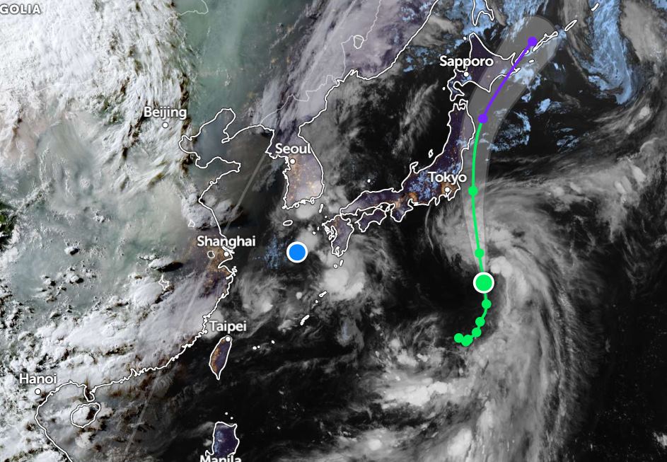
Due to the impact of Typhoon Nari, heavy rain and thunderstorms, strong gusts of wind are expected in the Ogasawara Islands and Izu Islands as well as the Kanto area tomorrow, July 14.
Meanwhile, tropical depression 07W is moving towards Kagoshima and Fukouka (Japan) with winds of 55km/h.
In the sea of Vietnam, on July 13, the Central and South East Sea (including Truong Sa special zone) will have scattered showers and thunderstorms.
It is forecasted that on the night of July 13 and July 14, scattered showers and thunderstorms will occur in the northern area of the Gulf of Tonkin, the central and southern East Sea (including the Truong Sa special zone), the sea area from Lam Dong to Ca Mau, from Ca Mau to An Giang and the Gulf of Thailand.
During thunderstorms, there is a possibility of tornadoes and strong gusts of wind. Waves are over 2m high.
Thunderstorms can endanger ships operating at sea, affecting maritime safety and fishing.
To ensure safety, vehicles need to proactively avoid and closely monitor weather forecasts and warnings from authorities to promptly respond when unfavorable situations occur.
People and tourists planning to travel to Japan or areas near the storm Nari should pay attention to weather forecasts and monitor flight schedules to avoid storms.


