According to the latest storm news from the Japan Meteorological Agency (JMA), the tropical depression in eastern Mindanao (Philippines) is being closely monitored due to the possibility of strengthening into a storm in the next 24 hours.
The Philippine Meteorological Agency (PAGASA) assesses the system's development potential at a high level, while the US Joint Typhoon Warning Center (JTWC) assesses it at an average level.
While PAGASA determined that the official tropical storm would form around 2 pm on January 15; JTWC forecasts that the tropical depression will become a storm around 7 pm on January 15.
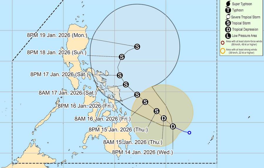
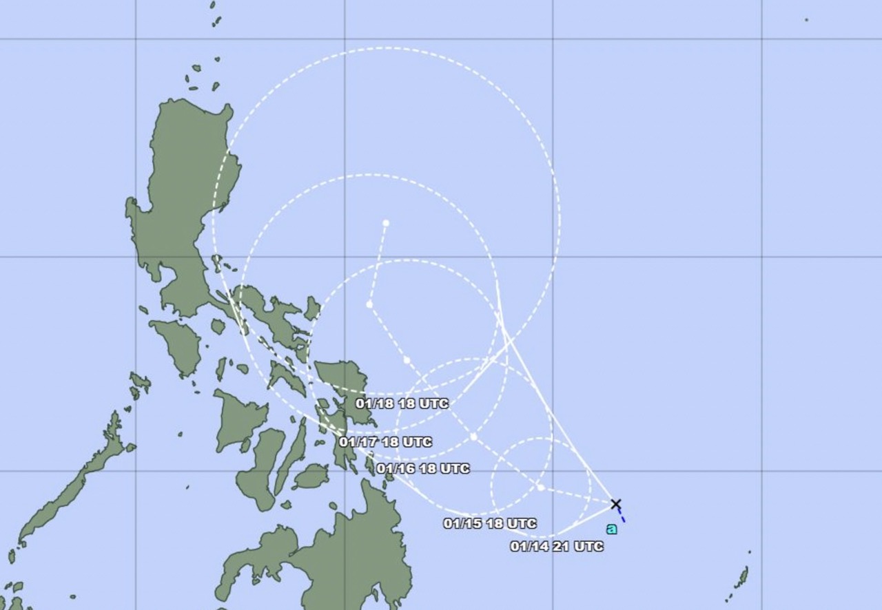
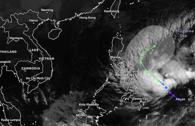
Based on international forecast models, the tropical depression will move in a Northwest to Northwest direction in the next 3 days, then change direction to the north when operating in the Philippine waters.
Meteorological agencies currently do not forecast a system of direct landfall in the Philippines in the short term, but the impact of bad weather is significant.
If it strengthens into a tropical storm, the system will be named Nokaen by the JMA.
According to the meteorological bulletin issued at 11 pm on January 14 from PAGASA, the center of the Ada tropical depression is located about 460 km east of Hinatuan (Surigao del Sur), with the strongest wind near the center of about 45 km/h, gusts of 55 km/h. The tropical depression is moving at a speed of about 20 km/h.
Due to the combination of tropical depression Ada and northeast monsoon, many areas of the Philippines are warned of heavy rain and strong gusts of wind, especially in coastal areas and high terrain.
Waves of 3-4 m high were recorded in many sea areas in the east and northern Philippines. Meteorological agencies recommend that small boats, tourist canoes, and coastal fishing vessels should not go out to sea, especially in rough seas areas.
Meanwhile, the National Center for Hydro-Meteorological Forecasting assessed that on the day and night of January 15, the sea area in the Northeast of the Northern East Sea area had strong Northeast winds at level 5, sometimes level 6, gusting at level 7; rough seas; waves 2.0-3.0m high.
Sea conditions due to tropical depressions or storms may affect the schedule of cruise ships, ferries, island tours and sea diving and coastal resort activities.
Tourists who are planning to go to the Philippines, islands in Visayas, Mindanao or travel on sea routes near the East Sea in the coming days need to closely monitor news bulletins about low pressure, tropical depression and storms.


