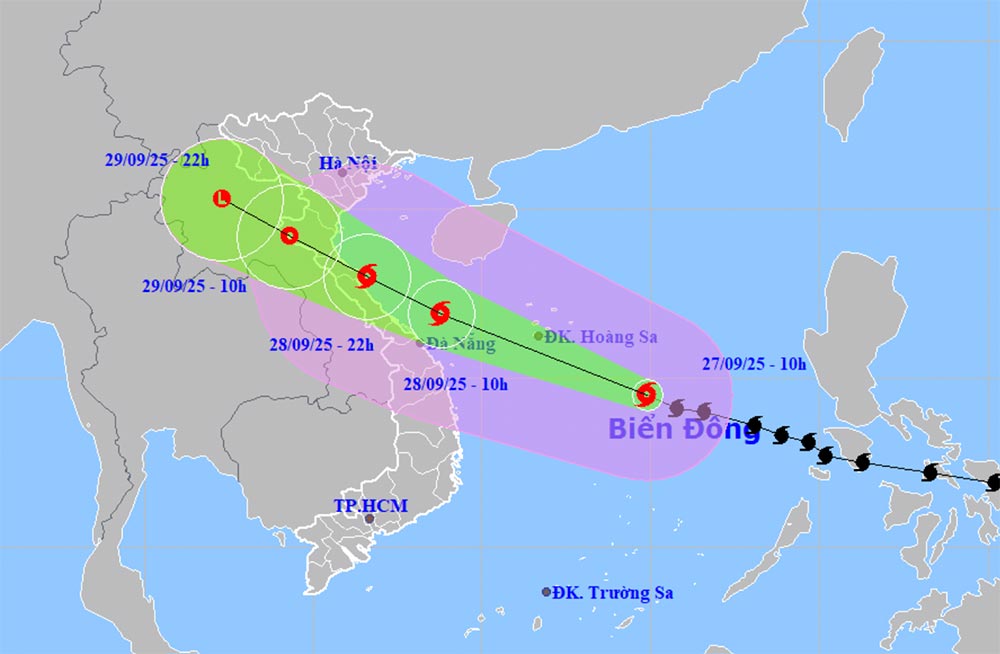
According to the latest storm news from the National Center for Hydro-Meteorological Forecasting, on the afternoon of September 27, storm No. 10 Bualoi was about 270km southeast of Hoang Sa Special Zone, about 640km east-southeast of Da Nang.
Intensity level 11-12 (103-133km/h), gust level 15.
The storm is moving west-northwest at a speed of about 35km/h, nearly double the average.
This is a strong storm with a wide range of impacts, capable of causing many types of natural disasters such as strong winds, heavy rain, floods, flash floods, landslides and coastal flooding.
It is forecasted that by 10:00 on September 28, storm No. 10 will move in a West-Northwest direction at a speed of about 30 km/h, likely to strengthen.
The center of the storm is located at about 16.9 degrees North latitude and 108.8 degrees East longitude, in the sea area from South Quang Tri to Quang Ngai, about 120 km East Northeast of Hue City.
Storm intensity level 12-13, gust level 16. The dangerous area is located from latitude 12.5 to 20.0 degrees North latitude and west of longitude 117.0 degrees East longitude.
The natural disaster risk level is level 3, affecting the North and Central East Sea (including Hoang Sa) and the sea area from Ha Tinh to Quang Ngai.
On the evening of September 27, the sea area from Thanh Hoa to Quang Ngai (including Hon Ngu, Con Co, Ly Son) had winds of level 6-7, gusts of level 8-9, waves 3-5 m high, and rough seas.
By early morning of September 28, the wind increased to level 8-9, near the storm center level 10-13, gusting to 16, waves 5-7 m, the sea was very rough.
The northern Gulf of Tonkin (including Bach Long Vy, Van Don, Co To, Cat Hai, Hon Dau) has winds of level 6-7, then increasing to level 8-9, gusts of level 11, waves 3-5 m high, very rough seas.
Due to the impact of storm No. 10 Bualoi, coastal areas and islands from Ninh Binh to Ha Tinh may rise 1-2 m, especially Thanh Hoa and Nghe An 1.5-2 m, causing the risk of flooding dykes, coastal roads and river mouths in the evening and night of September 28.
On land, from the afternoon of September 28, the Thanh Hoa to North Quang Tri area will have winds of level 6-7, then increase to level 8-9, near the center of the strong storm level 10-12, gust level 14, dangerous with the risk of falling trees, electric poles and damaging houses. The areas of Quang Ninh - Ninh Binh and South Quang Tri - Hue have winds of level 6-7, gusting to level 8-9.
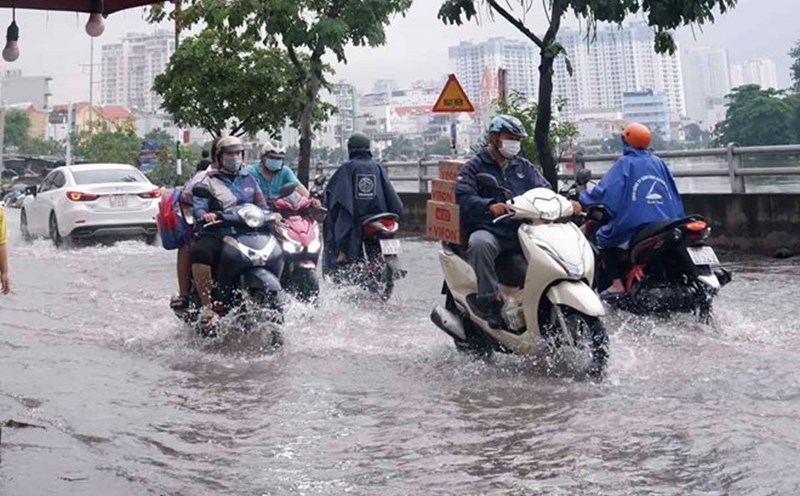
Heavy rain is forecast to occur from the night of September 27 to September 30 in the North and from Thanh Hoa to Quang Ngai with rainfall of 100-300 mm, some places over 450 mm.
In particular, the Northern Delta, South Phu Tho and from Thanh Hoa to North Quang Tri will have very heavy rain of 200-400 mm, locally over 600 mm.
The Joint Typhoon Warning Center (JTWC) recorded that Typhoon Bualoi forecasts that Typhoon Bualoi will continue to move west-northwest, heading straight towards the coast of Central Vietnam.
Current atmospheric conditions are very favorable, allowing storms to rapidly increase in strength throughout their movement. It is forecasted that in the next 36 hours, Bualoi could reach wind speeds of up to 185 km/h, becoming a very strong storm before making landfall.
Recommendation for tourists: in the next 1-2 days, the central region of Vietnam and neighboring coastal areas will be strongly affected by storm Bualoi, with the risk of gusts of wind, big waves and prolonged heavy rain.
Tourists should closely monitor weather forecasts, postpone sea trips or outdoor activities, and prepare safer travel plans.