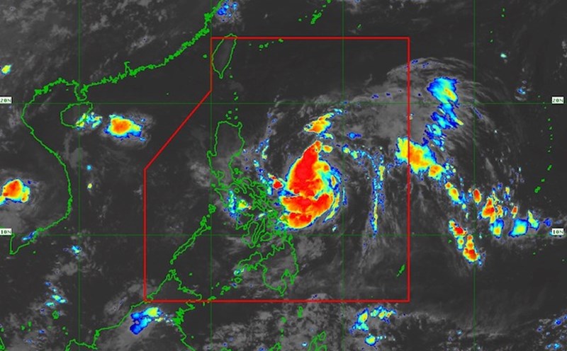
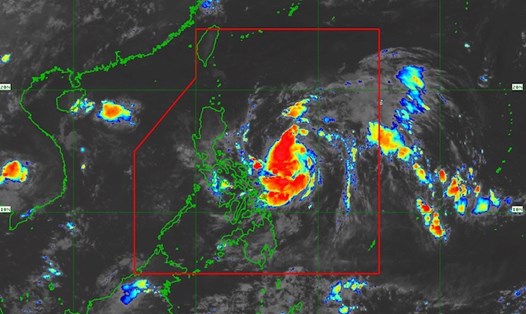
According to the Philippine Atmospheric, Geophysical and Astronomical Services Administration, Typhoon Matmo is moving rapidly northwest across the Philippine Sea.
As of 7:00 p.m. on October 2 (local time), the center of the storm was at about 15.7 degrees North latitude - 125.1 degrees East longitude, about 370 km east of Baler, Aurora. The strongest wind near the center of the storm reached 85 km/h, gusting up to 105 km/h. The storm continues to move northwest at a speed of 20 km/h. Strong winds extend up to 350 km from the center.
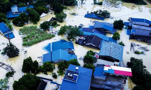
Due to the storm's impact, the southern part of mainland Cagayan, Isabela, the northern part of Quirino, the northern part of New New Mexico Vizcaya, the southern part of Apayao, Abra, Kalinga, the Mountain Province, Ifugao, the northern part of Benguet, the central and southern part of Ilocos Sur, and the northern part of Aurora will have strong winds of 62-88 km/h. Large gios pose a small threat to life and property.
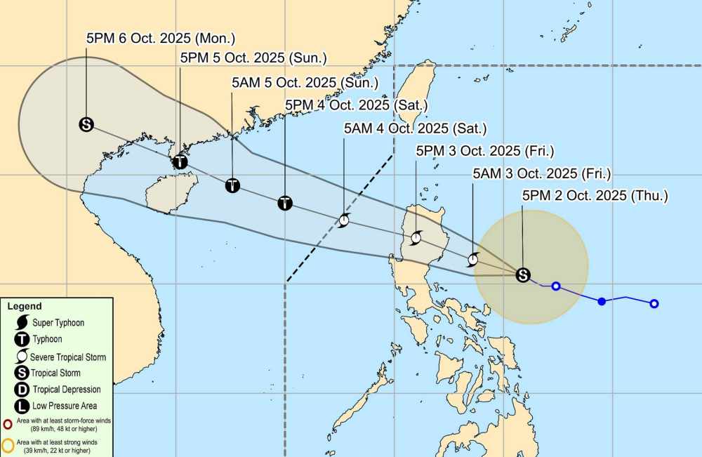
PAGASA forecasts that Typhoon Matmo will strengthen into a severe tropical storm before making landfall in the Philippines tomorrow afternoon, October 3.
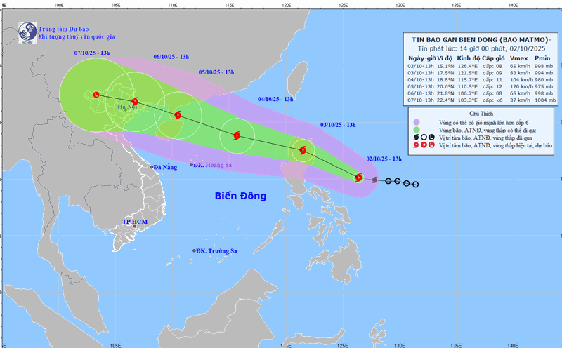
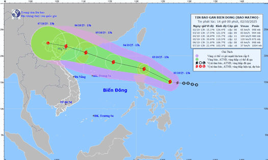
According to the National Center for Hydro-Meteorological Forecasting, by 1:00 p.m. on October 3, storm Matmo will move in a West-Northwest direction at a speed of about 25km/h and is likely to strengthen. The center of the storm is located at about 17.5 degrees North latitude - 121.5 degrees East longitude, on the mainland north of Luzon Island (Philippines). The strongest wind near the storm center is level 9, gusting to level 11. Natural disaster risk level: level 3 for the eastern sea area of the North East Sea.
Typhoon Matmo is forecast to strengthen into a typhoon as it enters the East Sea.
Due to the influence of the storm, at noon and afternoon of October 3, the eastern sea area of the North East Sea will have winds gradually increasing to level 6-7, near the storm center level 8-9, gusting to level 11. Waves are 3.0-5.0m high, the sea is very rough. In addition, from noon and afternoon of October 3, the eastern sea area of the North East Sea will have storms and rain.
On the night of October 3 and 4, the sea area north of the North East Sea will have winds gradually increasing to level 8-9, near the storm center level 10-11, gusting to level 13. Waves are 4.0-6.0m high, with rough seas.
The sea area south of the North East Sea (including Hoang Sa special zone) will have winds gradually increasing to level 6-7, gusting to level 9. Waves 3.0-5.0m high, rough seas.
All ships operating in the above areas are at high risk of being affected by strong winds and large waves.
People and tourists planning to visit these coastal areas should pay attention to weather forecasts. Tuan follows local instructions to ensure safety.