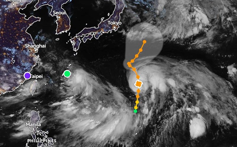
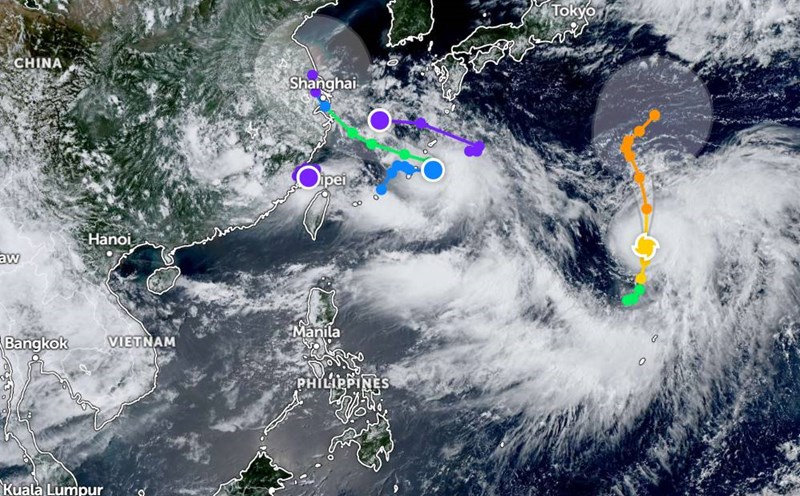
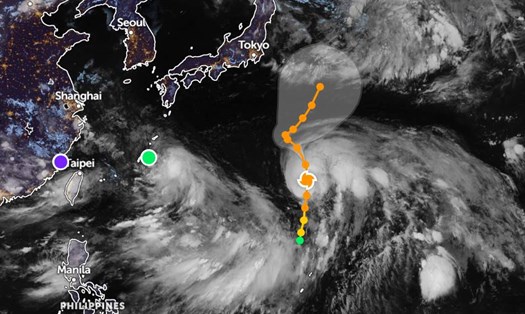
According to the Joint Typhoon Warning Center (JWTC), typhoon No. 4 Co May (international name: Co-may) is active at sea. As of 7:00 a.m. on July 29, the center of the storm was about 335 km west-northwest of Okinawa Island, Japan. In the past 6 hours, the storm has been moving northwest at a speed of 11km/h. The maximum wave height is 4.9 meters.
Typhoon No. 4 Co May is forecast to continue moving northwest in the next 24 hours, towards the sea and mainland of Guangzhou and Shanghai (China). The strongest wind near the center of the storm reached 65km/h.
Typhoon No. 4 Co May is forecast to approach the east coast of China in the next 30 hours. By 7:00 a.m. on July 30, the storm is expected to approach the mainland with the strongest winds of up to 65 km/h.
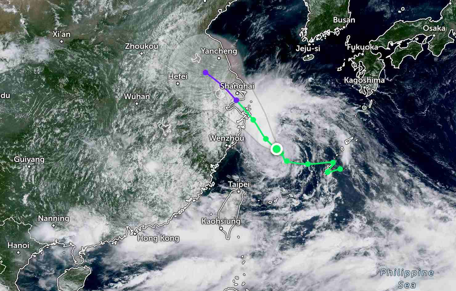
By 7:00 p.m. the same day, the storm moved inland in Shanghai (China) and weakened into a tropical depression.
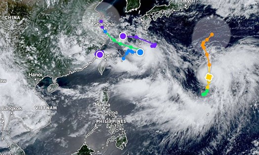
Meanwhile, Typhoon Krosa - Japan's Ninth Typhoon, is about 433km north-northeast of Iwo To Island. In the past 6 hours, the storm has been moving north at a speed of 7km/h. The maximum wave height is 7.6 meters (25 feet).
Typhoon Krosa is forecast to continue moving slowly in the North-Northwest direction over the next 120 hours and gradually weaken. However, Typhoon Krosa will remain as a strong tropical storm in the next few days.
According to the National Center for Hydro-Meteorological Forecasting, by 10:00 a.m. on July 29, in the North East Sea, the sea area from Ca Mau to An Giang and the Gulf of Thailand will have scattered showers and thunderstorms. Phu Quy Special Zone has strong winds of level 6, gusting to level 8. The eastern sea area of the northern East Sea will have strong winds of level 6-7.
It is forecasted that on the day and night of July 29, the North and Central East Sea (including Hoang Sa special zone) will have strong winds of level 6-7, gusting to level 9. Strong seas, high waves 2.0-5.0.
The sea area from Quang Ngai to Ho Chi Minh City has strong winds of level 6, gusting to level 7-8. Rough seas, waves 2.0-4.0m high.
In addition, the North East Sea area (including Hoang Sa special zone), the sea area from Ca Mau to An Giang and the Gulf of Thailand will continue to have scattered showers and thunderstorms. During thunderstorms, there is a possibility of tornadoes and strong gusts of wind of level 7-8.
On the day and night of July 30, the North and Central East Sea (including Hoang Sa special zone) will have strong southwest winds of level 6-7, gusting to level 9. Waves 3.0-5.0m high, rough seas.
The sea area from Quang Ngai to Ho Chi Minh City will have strong southwest winds of level 6, gusting to level 7-8. Waves are 2.0-4.0m high, rough seas.
People and tourists planning to visit the above areas should pay attention to weather forecasts. Follow local instructions and instructions to avoid dangerous storms, strong winds, and tornadoes.