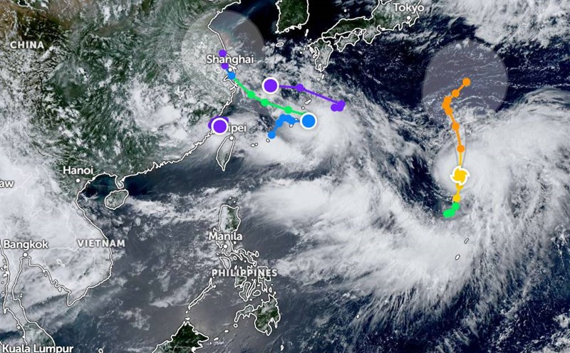
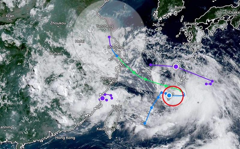
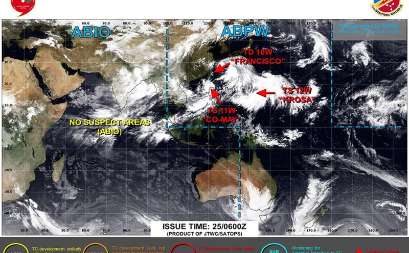
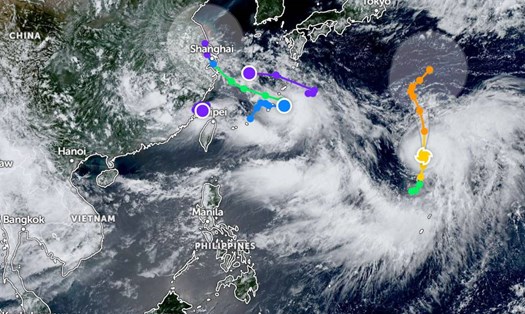
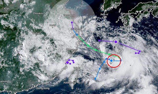
According to the latest storm information from the Philippine Atmospheric, Geophysical and Astronomical Services Administration, the tropical depression weakened from Typhoon Co May has revived into a tropical storm.
As of 3:00 a.m. on July 28, the center of the storm was at about 26.6 degrees North latitude - 129.1 degrees East longitude, about 985km northeast of the northernmost tip of Luzon.
The strongest wind near the center of the storm reached 75km/h, gusting up to 130km/h. The storm is moving northwest at a speed of about 15km/h, towards the areas of Guangzhou and Shanghai (China).
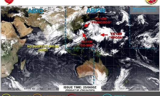
Meanwhile, Typhoon Krosa continues to strengthen at sea. The center of the storm is located at about 24.5 degrees North latitude - 145.4 degrees East longitude, about 2,455km northeast of the northernmost tip of Luzon.
The strongest wind near the center of the storm reached 150km/h, gusting up to 160km/h. The storm is moving north at a speed of 30km/h.
Currently, these storms do not affect the weather in the East Sea. However, many areas are experiencing thunderstorms.
According to the National Center for Hydro-Meteorological Forecasting, during the day and night of July 28, the northern East Sea (including Hoang Sa special zone) and the central East Sea will have strong southwest winds of level 6, sometimes level 7 at night, gusting to level 8-9. Waves are 2.0-4.5m high, rough seas.
The sea area from Gia Lai to Ho Chi Minh City will have strong southwest winds of level 6, gusting to level 7-8. Waves are 2.0-4.0m high, rough seas.
In addition, the North and Central East Sea, the sea area from Lam Dong to Ca Mau, from Ca Mau to An Giang and the Gulf of Thailand will have scattered showers and thunderstorms. During thunderstorms, there is a possibility of tornadoes and strong gusts of wind of level 7-8.
Day and night of July 29, the North and Central East Sea have southwest winds of level 6, sometimes level 7, gusting to level 8-9. Waves are 2.0-4.5m high, rough seas.
The sea area from Gia Lai to Ho Chi Minh City will have southwest winds of level 6, gusting to level 7-8. Waves are 2.0-4.0m high, rough seas.
All ships operating in the above sea areas are at high risk of being affected by tornadoes, strong winds and large waves. Fishermen and captains need to closely monitor the forecast, proactively prevent and ensure safety.
People and tourists in these coastal areas should pay attention to weather forecasts. Tuan follows local instructions to avoid dangerous storms.