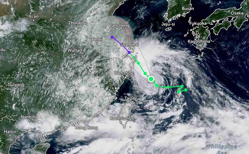
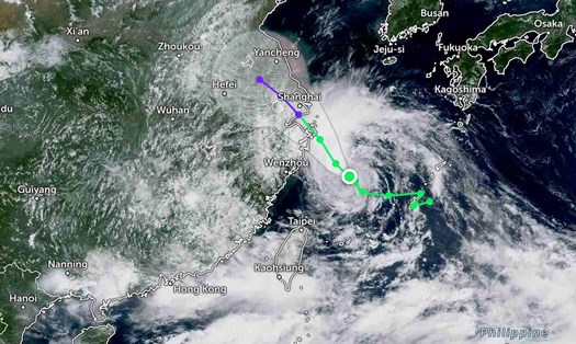
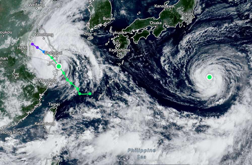
According to the Joint Typhoon Warning Center (JWTC), Typhoon No. 4 Co May (international name: Co-may) is strengthening into the sea. On the morning of July 30, the center of the storm was about 250km south-southeast of Shanghai (China).
In the previous 6 hours, the storm moved north - northwest at a speed of 17km/h, with maximum waves reaching 4.9m. The strongest wind near the center of the storm has increased to 75km/h.
Typhoon Co May is expected to continue moving northwest. The storm will make landfall on the islands southeast of Shanghai (China) today, then cross Hangzhou Bay, making landfall in the Shanghai area.
The storm's intensity is expected to change little or no change before making landfall.
After making landfall, storm No. 4 Co May will gradually weaken. The storm will continue to move northwest for the next 36 hours, slowing down.
Meanwhile, Typhoon Krosa is also moving in a circle over the sea off the coast of Japan.
On the morning of July 30, the storm moved north at a slow speed of about 2km/h, about 789km south-southeast of Yokosuka (Japan). The largest wave height is estimated at 6.7 meters. Typhoon Krosa continues to drift slowly to the North.
It is forecasted that in the next 3 days, Typhoon Krosa will accelerate north and then turn northwest.
During this process, Typhoon Krosa will strengthen into a severe tropical storm and not make landfall in Japan. The storm is forecast to sweep across the southeast of Honshu or move far offshore.
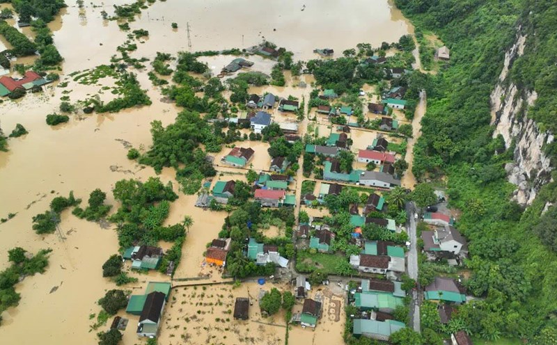
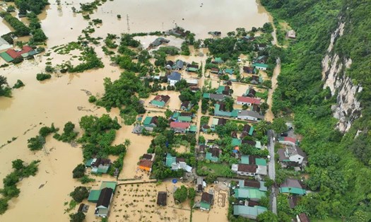
According to the National Center for Hydro-Meteorological Forecasting, on the morning of July 30, the North East Sea area had scattered showers and thunderstorms, especially Phu Quy area had gusts of level 8.
It is forecasted that during the day and night of July 30, the North and Central East Sea (including Hoang Sa special zone) will have strong winds of level 6-7, gusting to level 8-9. Strong sea, waves 2.0-5.0m high.
The sea area from Gia Lai to Ho Chi Minh City has strong winds of level 6, gusting to level 7-8. Rough seas, waves 2.0-4.0m high.
In addition, on the day and night of July 30, the North East Sea (including Hoang Sa special zone) and the Gulf of Thailand will have scattered showers and thunderstorms. During thunderstorms, there is a possibility of tornadoes and strong gusts of wind of level 78.
During the day and night of July 31, the North and Central East Sea (including Hoang Sa special zone) will have strong southwest winds of level 6-7, gusting to level 8-9, waves 2.0-5.0m high, and rough seas.
The sea area from Gia Lai to Ho Chi Minh City will have strong southwest winds of level 6, gusting to level 7-8, waves 2.0-3.5m high, rough seas.
People and tourists planning to visit the above areas should pay attention to weather forecasts. Follow local instructions and instructions to avoid dangerous storms, strong winds, and tornadoes.