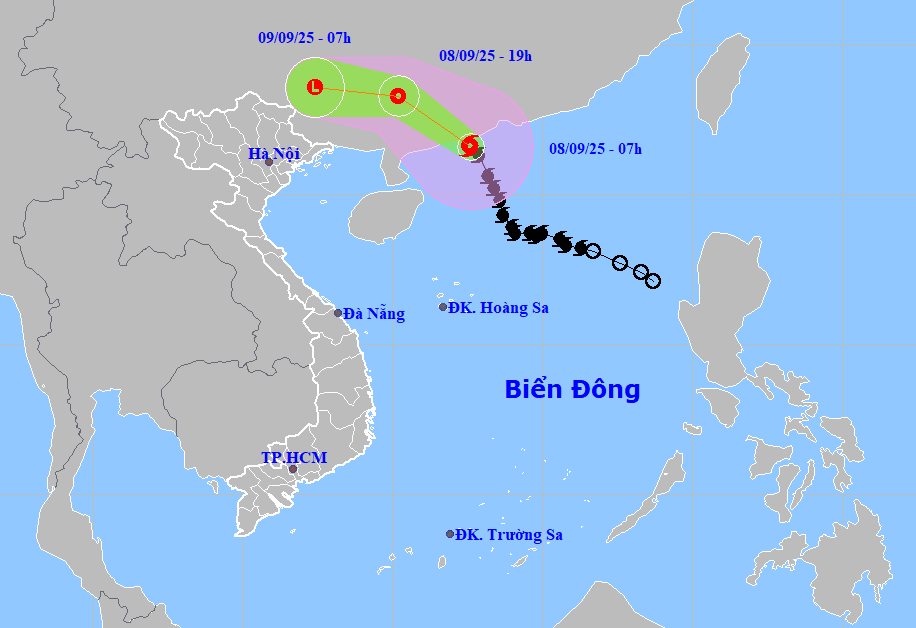
According to the National Center for Hydro-Meteorological Forecasting, at 7:00 a.m. on September 8, the center of storm No. 7 was at about 21.6 degrees North latitude; 112.6 degrees East longitude, in the coastal waters of Guangdong province (China).
The strongest wind near the storm center is level 11 (103-117km/h), gusting to level 13. Moving north-northwest at 20-25km/h.
It is forecasted that by 7:00 p.m. on September 8, storm No. 7 will move northwest at a speed of 20-25km/h and gradually weaken into a tropical depression. The center of the tropical depression is located at about 23.3 degrees North latitude - 110.2 degrees East longitude, in the mainland of Guangxi province (China).
The strongest wind near the center of the tropical depression is level 7, gusting to level 9. Natural disaster risk level: level 3 for the northwestern sea area of the North East Sea.
At 7:00 a.m. on September 9, the tropical depression moved in the West Northwest direction at a speed of 20-25km/h and continued to weaken into a low pressure area. The center of the low pressure is located at about 23.6 degrees North latitude - 107.4 degrees East longitude, on the mainland of Guangxi province (China). Wind speed is less than level 6.
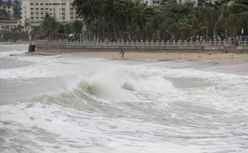
Due to the influence of storm No. 7, the northwestern sea area of the North East Sea will have strong winds of level 6-8, near the center of the storm will have strong winds of level 10-11, gusts of level2; waves 4.0-6.0m high, the sea will be very rough. Ship operating in the above-mentioned dangerous areas are likely to be affected by thunderstorms, whirlwinds, strong winds, and large waves.
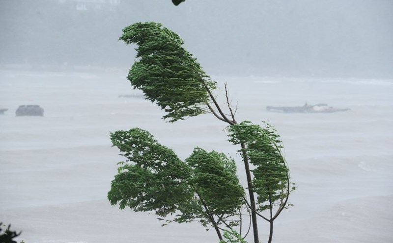
Although not directly affected by the storm's circulation, areas on the far edge of the storm's circulation such as the Gulf of Tonkin and the eastern coastal areas of the North may experience thunderstorms, whirlwinds and strong gusts of wind.
The northwest sea area of the North East Sea will have strong winds of level 7-8, near the center of the storm will have strong winds of level 9-11, gusts of level2; waves 4.0-6.0m high; very rough seas. At night the wind gradually decreases.
The North East Sea area (including Hoang Sa special zone), the Central and South East Sea area (including Truong Sa special zone), the Gulf of Tonkin, the sea area from Lam Dong to Ca Mau, from Ca Mau to An Giang, the Gulf of Thailand will have scattered showers and thunderstorms; the Northwest sea area of the North East Sea will have storms during the day.
During thunderstorms, there is a possibility of tornadoes, strong gusts of wind of level 6-7 and waves over 2.0m high.
People and tourists planning to visit these areas should pay attention to weather forecasts. Tuan follows local instructions to avoid dangerous storms.