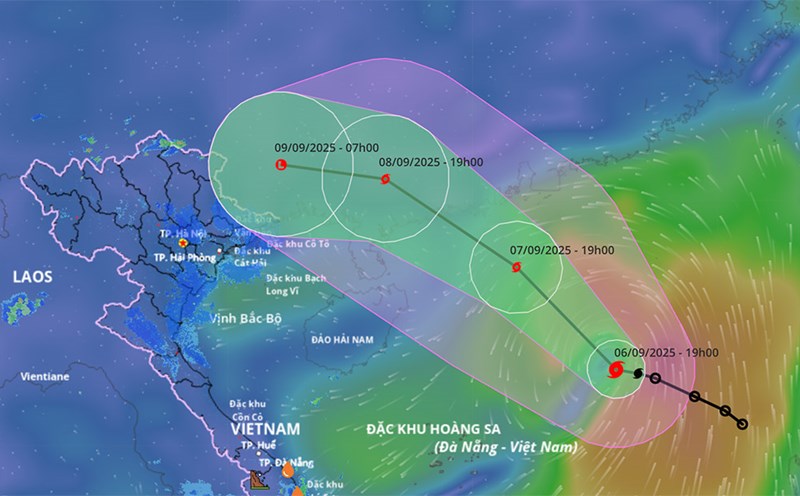
According to the latest weather forecast from the National Center for Hydro-Meteorological Forecasting, at 4:00 p.m. on September 7, the center of storm No. 7 Tapah was at about 19.3°N - 113.7°E, in the northern sea area of the North East Sea.
The strongest wind near the storm center is level 9-10 (75-102km/h), gusting to level 13. The storm is moving northwest at a speed of about 10-15km/h.
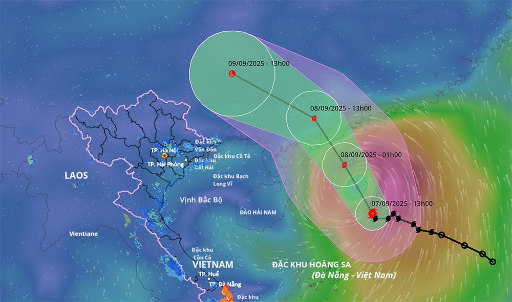
It is forecasted that by 4:00 a.m. on September 8, the storm will move north-northeast at a speed of about 20km/h. The center of the storm is located at about 21.2°N - 112.6°E, about 180km southwest of Macau (China).
The storm intensity reached level 10, gusting to level 13. The danger zone is determined from the north of latitude 17.5°N, longitude 111.0°E to 116.5°E. Natural disaster risk level: level 3, in the northern sea area of the North East Sea.
At 4:00 p.m. on September 8, the storm continued to move northwest at a speed of about 20km/h, entering the mainland south of Guangdong province (China).
The center of storm No. 7 Tapah is at about 22.9°N - 111.2°E, the intensity has decreased to level 7, gusting to level 9. The danger zone is from the north of latitude 18.5°N, longitude 110.5°E to 115.0°E. Natural disaster risk level: level 3, in the northern sea area of the North East Sea.
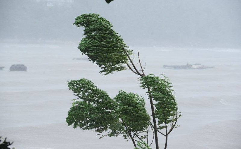
The sea area north of the North East Sea is forecast to have strong winds of level 7-8, near the storm center level 9-10, gusting to level 13.
Waves are 4.0-6.0m high, the sea is very rough. Ship in the danger zone are likely to be affected by thunderstorms, whirlwinds, strong winds and large waves.

Although not directly affected by the storm's circulation, areas on the far edge of the storm's circulation such as the Gulf of Tonkin and the coastal areas of the Northeast may experience thunderstorms, whirlwinds and strong gusts of wind.
In coastal areas and islands in the Gulf of Tonkin, visitors should closely monitor forecast information, limit travel by boat, and prepare safety plans when there are thunderstorms and strong gusts of wind.
Weather forecast for the night of September 7 and September 8:
Hanoi Lowest temperature: 27-29 degrees Celsius Highest temperature: 34-36 degrees Celsius Cloudy, no rain at night, hot sunny during the day.
Light wind.
Northwest Lowest temperature: 24-27 degrees Celsius, some places below 23 degrees Celsius Highest temperature: 32-35 degrees Celsius, some places above 35 degrees Celsius Cloudy, showers and thunderstorms in the evening and at night, sunny during the day, some places are hot.
Light wind.
Northeast Lowest temperature: 25-28 degrees Celsius, mountainous areas below 25 degrees Celsius Highest temperature: 33-36 degrees Celsius Cloudy, showers and thunderstorms in the evening and at night, sunny during the day, hot in some places.
Light wind.
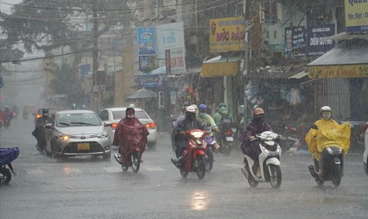
Thanh Hoa to Hue Lowest temperature: 25-28 degrees Celsius Highest temperature: 31-34 degrees Celsius, some places above 34 degrees Celsius Cloudy, scattered showers and thunderstorms in some places, scattered showers and thunderstorms in the late afternoon and night, locally heavy rain in some places.
Light wind.During thunderstorms, there is a possibility of tornadoes, lightning and strong gusts of wind.
South Central Coast Lowest temperature: 24-27 degrees Celsius Highest temperature: 30-33 degrees Celsius Cloudy, rain in the evening and at night, moderate rain and scattered thunderstorms, locally heavy to very heavy rain; day with scattered showers and thunderstorms, locally heavy rain.
Southwest wind level 2-3.During thunderstorms, there is a possibility of tornadoes, lightning and strong gusts of wind.
Central Highlands Lowest temperature: 20-23 degrees Celsius Highest temperature: 26-29 degrees Celsius, some places above 29 degrees Celsius Cloudy, rain in the evening and at night, moderate rain and scattered thunderstorms, locally heavy rain to very heavy rain; day there are scattered showers and thunderstorms, locally heavy rain.
Southwest wind level 2-3.During thunderstorms, there is a possibility of tornadoes, lightning and strong gusts of wind.
Southern region Lowest temperature: 24-27 degrees Celsius Highest temperature: 29-32 degrees Celsius, some places above 32 degrees Celsius Cloudy, rain in the evening and at night, moderate rain and scattered thunderstorms, locally heavy to very heavy rain; day there are scattered showers and thunderstorms, locally heavy rain.
Southwest wind level 2-3.During thunderstorms, there is a possibility of tornadoes, lightning and strong gusts of wind.
Ho Chi Minh City. Lowest temperature: 25-27 degrees Celsius Highest temperature: 30-32 degrees Celsius Cloudy, moderate rain, heavy rain and thunderstorms in the evening and at night; scattered showers and thunderstorms during the day, locally heavy rain.Southwest wind level 2-3.
During thunderstorms, there is a possibility of tornadoes, lightning and strong gusts of wind.