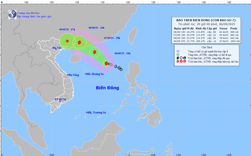
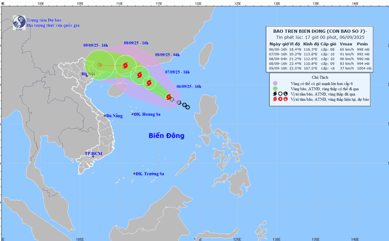
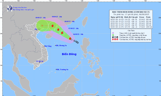
The tropical depression in the northeastern sea of the East Sea has officially strengthened into storm No. 7 Tapah, according to the National Center for Hydro-Meteorological Forecasting.
The strongest wind near the storm center is level 8 (62-74km/h), gusting to level 10. Moving northwest, speed 10-15km/h.
By the evening of September 7, when still about 420 km northeast of the Hoang Sa archipelago, storm No. 7 Tapah is forecast to strengthen, with winds of 75-102 km/h, gusts of up to 133 km/h, but the speed of movement may slow down.
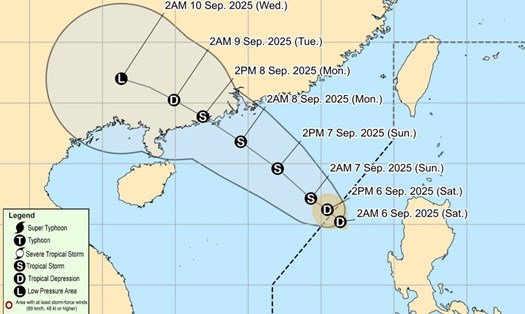
On the afternoon of September 8, the storm will be about 110 km south-southeast of Hong Kong (China), strong at level 9-10, gusting to level 12-13, and is likely to continue to strengthen before making landfall in Guangdong province (China).
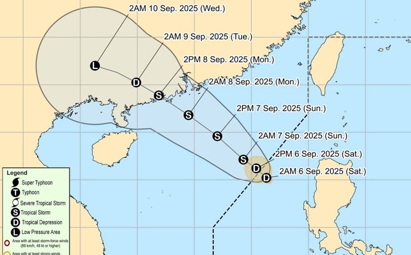
According to the Joint Typhoon Warning Center (JTWC), the largest wave height near the center of the storm will reach about 4.6 m.
Typhoon Tapah is forecast to reach its peak intensity, with winds of up to 120 km/h when approaching the mainland of Guangdong province (China) in the early morning of September 8.
The Japan Meteorological Agency (JMA) forecasts Tapah to reach a peak of about 72 km/h before weakening into a low pressure area on land. The remnants of the storm then moved westward, affecting the northern mountainous provinces of Vietnam.
Meanwhile, the Hong Kong Meteorological Station (China) said that the strongest winds could reach 90 km/h, gradually decreasing but still affecting Ha Giang, Cao Bang and Lang Son.
Currently, Typhoon Tapah is causing very rough seas. The northeastern East Sea has winds of level 6-7, near the storm center level 8-9, gusting to level 11-13. Waves are 3-5 m high, causing danger to ships.
The Ministry of Agriculture and Environment has requested coastal localities from Quang Ninh to Dak Lak to closely monitor the situation, count ships and prepare rescue forces.
Tapah is the 7th storm to appear in the East Sea this year.
Previously, storm No. 6 Nongfa made landfall in Ha Tinh - Quang Tri, while storm Kajiki affected Thanh Hoa - Ha Tinh on August 25, killing and leaving missing 9 people, injuring 77, and causing economic losses of about VND2.9 trillion ($114 million).
According to meteorological experts, from now until the end of the year, there may be 5-7 storms or tropical depressions in the East Sea, of which 2-3 are likely to directly affect the mainland of Vietnam. The cold front could soon return, making flooding worse in the coming months.