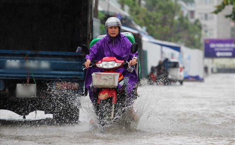
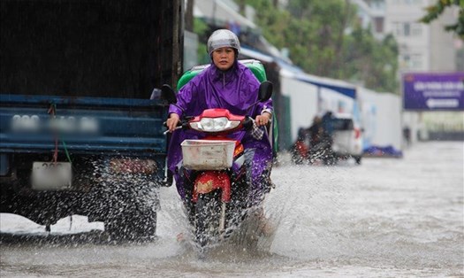
According to the rain forecast of the National Center for Hydro-Meteorological Forecasting, in the afternoon and evening of yesterday (May 27), the Southern region experienced showers and thunderstorms, including heavy to very heavy rain in some places.
Rain occurred locally, concentrated in the afternoon and evening, affecting traffic and daily life in some areas.
In the next 24 to 48 hours, many areas across the country will continue to have heavy rain. In the North, from the evening of May 28 to early morning of May 30, there is a forecast of moderate rain, heavy rain, and very heavy rain in some places with common rainfall from 40-100mm, some places may exceed 200mm.

The North Central region also recorded increased rain from early morning of May 29 to early morning of May 30. Rainfall is forecast to be generally from 30-70mm, locally over 120mm.
In the South Central region, in the late afternoon and evening of May 28, there will be scattered showers and thunderstorms. Some places may experience heavy rain with common rainfall from 15-30mm, with some points over 60mm.
In the Central Highlands and the South, from the afternoon of May 28 to the end of May 29, there will be moderate to heavy rain, concentrated in the afternoon and evening.
Rainfall is generally from 30-60mm, locally very heavy rain, exceeding 100mm.
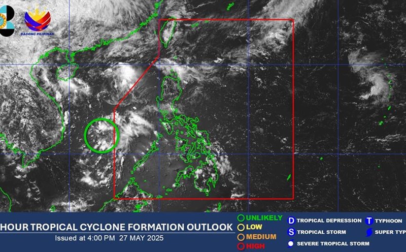
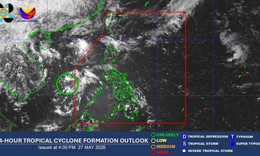
From May 28, the low pressure trough with an axis of 25-28 degrees North latitude will be compressed and pushed south by the continental high pressure in the North.
The low pressure trough continues to compress the North Central region, then gradually increases; from about 30-31, the low pressure area in the West tends to expand again to the Southeast.
Therefore, the weather in the South will continue to have showers and thunderstorms, with the possibility of moderate to heavy rain.
During the rains, there is a possibility of very heavy rain, exceeding 100mm in just 3 hours. This is a situation with many potential risks, especially in complex terrain areas, urban areas or low-lying areas.
Prolonged heavy rain can cause some serious effects such as: flooding in low-lying areas, urban areas, industrial parks; flash floods in small rivers and streams; landslides in areas with steep terrain and weak soil.
From tonight (May 28) to May 29, on the Thao River, the Lo River, and small rivers in the Northern region and Thanh Hoa, there is a possibility of 01 flood, with a flood amplitude of 2-5m on the rivers. During this flood, flood peaks on small rivers and upstream rivers are likely to rise to level BD1 and above level 1. The downstream water level of major rivers is still below level BD1.
The meteorological agency warns of the risk level of natural disasters due to floods: Level 1. There is a high risk of flooding in low-lying areas along rivers, flash floods and landslides on steep slopes in the mountainous areas of the North and Thanh Hoa.
People and tourists are advised to closely monitor weather developments, update the latest news and proactively take safety precautions.
From May 30 onwards, heavy rain in the above areas will gradually decrease. However, in the short term, heavy rain still poses many potential risks of natural disasters.