According to the latest storm information from the Philippine Atmospheric, Geophysical and Astronomical Services Administration (PAGASA), two new low pressure areas are likely to form near the East Sea between now and early December.
The first low pressure is forecast to appear during the week of November 19-25, within PAGASA's TCAD forecast area, then enter the Philippine Area of Responsibility (PAR). This low pressure is likely to be low to moderate to develop into a tropical depression or storm.
However, this low pressure will continue to operate until the week of November 26-212. During that period, the low pressure will affect the Visayas - Southern Luzon (Philippines) area, then enter the East Sea. At this time, the low pressure is likely to strengthen into a tropical depression or storm at low to moderate levels when operating in the East Sea.
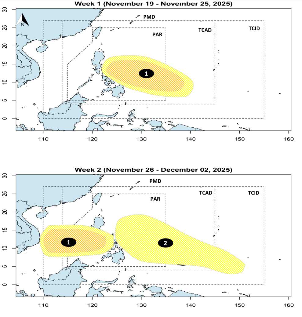
The second low pressure is forecast to form in the PMD area and then enter the Philippine Area of Responsibility (PAR). This low pressure is unlikely to strengthen into a tropical depression or storm.
According to the National Center for Hydro-Meteorological Forecasting, there are about 1-2 storms or tropical depressions likely to appear in the East Sea between the fourth quarters of November 11 and December 10. This low pressure or storm is likely to affect the mainland of Vietnam.
Meanwhile, cold air is more likely to increase in frequency and intensity during this period. Widespread heavy rain occurred in the Central region, especially from South Quang Tri to Da Nang, Dong Quang Ngai to Dak Lak, Khanh Hoa. The Southern and Central Highlands regions may experience several waves of showers and thunderstorms.
The tropical depression with cold air during this period is likely to cause cold rain in many places. People and tourists should pay attention to weather forecasts to update the situation, bring heat-reserving metals and raincoats when going to affected areas.


