Typhoon No. 14 Fung-wong has weakened into a low pressure area after making landfall in Taiwan (China) and the Philippines earlier.
According to the weather forecast on November 14, the Philippine Meteorological Agency said that no low pressure areas are currently being monitored for the possibility of becoming tropical cyclones.
This shows that the signal of low pressure formation right after storm No. 14 Fung-wong, although predicted in previous models, has now decreased significantly and no clear structure has appeared in reality.
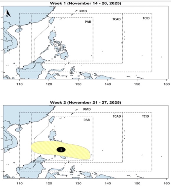
However, PAGASA's long-term bulletins still record the possibility of low pressure forming in the eastern edge of the PAR forecast area.
In the latest news, a low pressure is forecast to have a path through the Philippines and then enter the East Sea, operating around November 21-27 and may approach the Vietnam area.
However, the low pressure is assessed to have little chance of strengthening into a storm or tropical depression.
Although the low pressure after Typhoon Fung-wong has not yet formed, visitors should still proactively monitor weather forecasts in the coming days, especially if they plan to travel by sea, visit islands or travel in the coastal provinces of the Central and South. The weather in the East Sea can change rapidly due to the existence of disturbances after major storms, so it is necessary to update information from the meteorological agency and prepare alternative options when there are new warnings.
If you have a long-distance travel schedule, check flight status, sea routes and outdoor activities to ensure safety.


