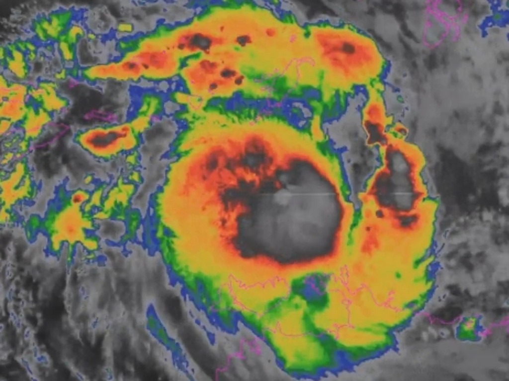
According to the latest storm information from the Australian Bureau of Meteorology (BOM), the storm has sustained winds of 95km/h, gusts of up to 130km/h and is likely to approach or make landfall on Friday or Saturday. It is also one of the earliest storms to form since the 1980s.
Where is fina?
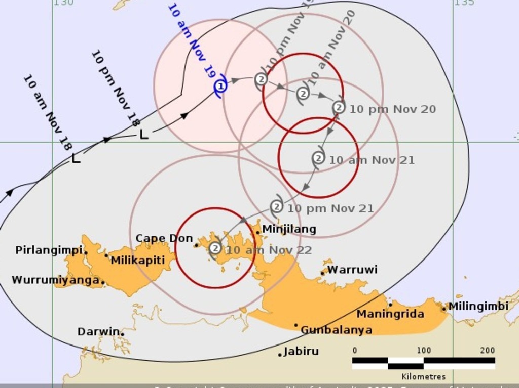
According to the latest storm forecast, the center of the storm is located about 375km northeast of Darwin, northern Australia; 185km north of Minjilang.
fina is forecast to change direction to the south, then turn southwest in the next 24-48 hours.
The storm is likely to make landfall in the western area of Minjilang on Saturday morning (November 22, local time)
Areas under warning are strongly affected by storm fina
Ward warning zone: From Maningrida to Cape Don, including Minjilang and Warruwi. People and tourists are required to immediately deploy measures to prevent storms, protect property and boats.
Watch Zone: All of Tiwi Islands, Darwin, Gunbalanya, Cape Fourcroy to Milingimbi. Tourists need to prepare a travel plan when the situation deteriorates.
How far can the storm strengthen?
BOM warns fina is likely to strengthen to Category 3 as it approaches the Top End coast (a strong typhoon in Australia, with gusts of 177 - 222 km/h and waves of about 2.6 - 3.3 m high, which could damage roofs and cause power outages).
The Darwin area is expected to be affected by heavy rain and strong winds from Friday (November 21 local time), peaking on Saturday (November 22).
The Joint Typhoon Warning Center (JWTC) forecasts the storm to reach Category 3 as it approaches land, with maximum sustained winds of about 150 km/h on the morning of November 22 (local time).
Weather impact of storm fina
Widespread heavy rain, many places have very heavy rain.
Wind gusts of 120-130km/h in coastal areas.
Dangerous high water and big waves in Tiwi Islands, Cape Hotham, Milingimbi.
Risk of high tides combined with storms causing coastal flooding when the storm's eye makes landfall.
Important notes before the development of storm fina
People and tourists continuously monitor storm forecasts from the BOM and local emergency agencies.
Limit travel by sea; comply with instructions on closing ferry terminals and tourist boats.
If you are in Darwin or Tiwi Islands, prepare a shelter plan, reserve water - food and fully charge your communication devices.
Check the schedule change and ticket refund policies of hotels and airlines when the weather is bad.
Do not access the beach during the storm warning period due to dangerous high waves and high tides.
According to meteorologists, fina is the first storm of the season, appearing about a month earlier than the average of many years. The last time the northern Australian territory was affected by such an early storm was when it welcomed Alessia (2013).


