Low pressure forecast to strengthen into storm and likely make landfall

Ninh Phương |

The low pressure near the East Sea is likely to strengthen into a tropical depression and continue to develop into a tropical storm in the next few days.

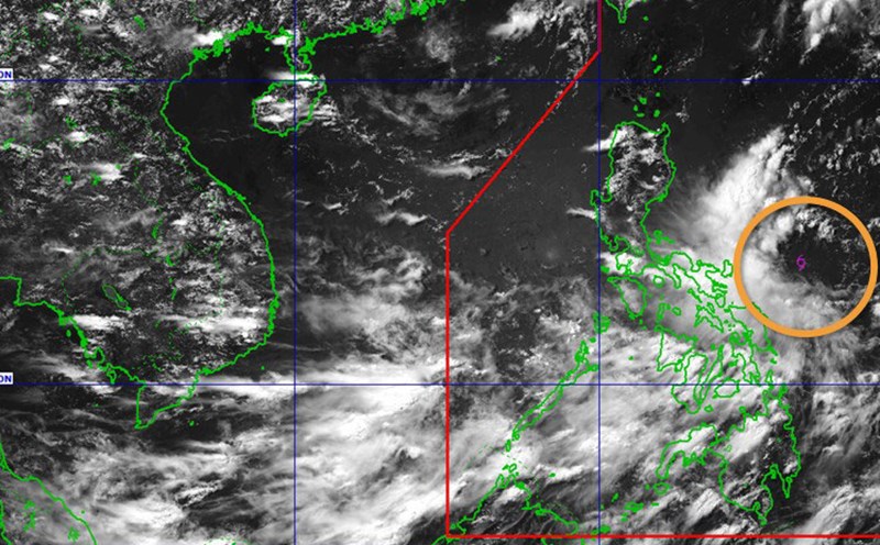
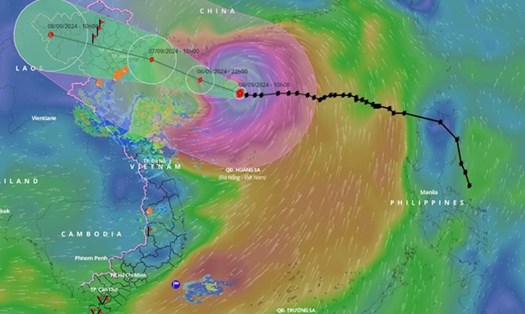
The low pressure is located about 240 km east of Virac (Catanduanes) at 3:00 a.m. on June 7 (local time), the Philippine Atmospheric, Geophysical and Astronomical Services Administration ( pagasa).

Based on our latest analysis, if it forms a tropical depression, the system is unlikely to make landfall in any part of the Philippines, Pagasa weather expert grace Castañeda said in the morning bulletin of June 7.

However, Ms. Castañeda said that this system will enhance the activity of the southwest monsoon, combined with the low pressure area causing rain in many places in the Philippines.

On Saturday, the low pressure area will mainly affect Central - Southern Luzon, Visayas and Mindanao, while the southwest monsoon will continue to dominate the weather in the western part of the country.

Currently, the low pressure has not affected the marine weather in Vietnam.

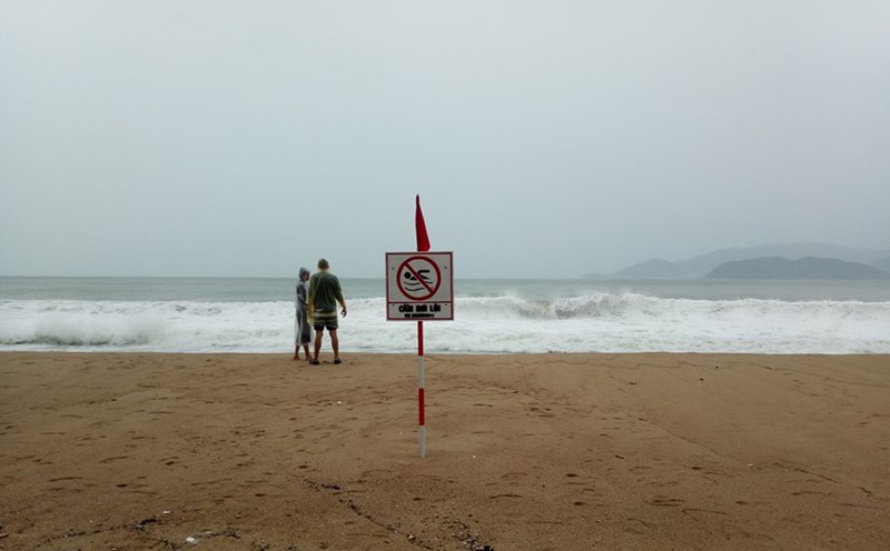
However, currently, the Central and South East Sea (including the Truong Sa archipelago), the sea area from Binh Thuan to Ca Mau has scattered showers and thunderstorms, according to the National Center for Hydro-Meteorological Forecasting.

Neu du khach dang luu tru tai cac dao hoac diem du lich ven bien, hay lang nghe va lam theo huong dan cua chinh quyen dia phuong, huong dan vien hoac ban quan ly khu du lich. Anh: Duy Tuan
If you are currently residing on islands or coastal tourist destinations, listen to and follow the instructions of local authorities, tour guides or the tourist management board. Photo: Duy Tuan

Forecast for the day and night of 27.6, the Central and South East Sea (including the Truong Sa archipelago), the sea area from Binh Thuan to Ca Mau, Ca Mau to Kien Giang and the Gulf of Thailand will have showers and thunderstorms.

During thunderstorms, there is a possibility of tornadoes, strong gusts of wind of level 6-7 and waves over 2.0m high.

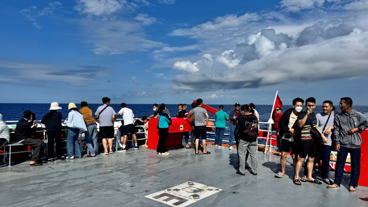
Tourists should avoid swimming, taking a boat to sea or taking a diving tour, fishing, canoeing, paragliding... when the weather is bad, because there is a potential risk of strong gusts of wind, tornadoes and high waves.

Tourists, fishermen and crew on boats operating in the above areas need to closely monitor weather developments and proactively prevent dangers from natural disasters.

Ninh Phương
TIN LIÊN QUAN

Forecast of the possibility of low pressure near the East Sea strengthening

|

The low pressure near the East Sea is being monitored by meteorologists for the possibility of strengthening into a storm.

Forecast of low pressure and storms near the East Sea in early June

|

The forecast of tropical depressions, storms and the southwest monsoon is likely to affect the activities of ships. Tourists need to pay attention when planning to go to the beach.

Forecast of more than 5 storms and depressions hitting the East Sea from now until August

|

Forecast for the 2025 storm season, the possibility of storms and tropical depressions operating in the East Sea is approximately the same as the average of many years.

Forecast of the possibility of low pressure near the East Sea strengthening

Ninh Phương |

The low pressure near the East Sea is being monitored by meteorologists for the possibility of strengthening into a storm.

Forecast of low pressure and storms near the East Sea in early June

Ninh Phương |

The forecast of tropical depressions, storms and the southwest monsoon is likely to affect the activities of ships. Tourists need to pay attention when planning to go to the beach.

Forecast of more than 5 storms and depressions hitting the East Sea from now until August

Chí Long |

Forecast for the 2025 storm season, the possibility of storms and tropical depressions operating in the East Sea is approximately the same as the average of many years.