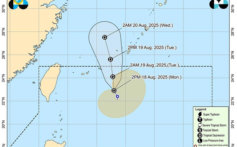
According to the latest low pressure information from the Joint Typhoon Warning Center (JTWC), tropical depression 18W (Philippine name: Huaning) is currently about 696 km south-southwest of Sasebo (Japan), moving north-northwest at a speed of about 22 km/h.
The highest waves were recorded at 4.9 meters.
In the next 2 days, the tropical depression will continue to move north and is likely to strengthen into a tropical storm with winds of about 65 km/h.
The storm is then forecast to weaken rapidly and gradually dissipate within 3 days.
Currently, forecast models show that the main direction of the storm is south of South Korea and Kyushu (Japan). However, there is still a certain chance of deviation in the storm's path.
The Philippine Atmospheric, Geophysical and Astronomical Services Administration (PAGASAP) forecasts that this tropical depression has a moderate chance of strengthening into a storm.
At the same time, a low pressure is near Yap Island (Micronesia).
In the next 24 hours, the possibility of tropical storm formation is still low.
Currently, the winds around this area are about 35-45 km/h, with an air pressure of 1008 hPa. Environmental conditions are only average for this system to strengthen into a tropical depression.
The low pressure is likely to continue moving northwest, towards Luzon Island (Philippines). However, there are still many differences in the forecast models for the possibility of a low pressure developing.
In the coming days, South Korea and western Japan (including Kyushu) may be affected by heavy rain, strong winds and rough seas.
Visitors to the Philippines, especially the Luzon area in the next few days, should pay attention to regularly monitoring weather forecasts even though the low pressure may not strengthen into a storm, but may cause showers, local thunderstorms and light sea rough seas.
Tourists should consider changing their travel schedule by sea or air, and prioritize safety when traveling outdoors.
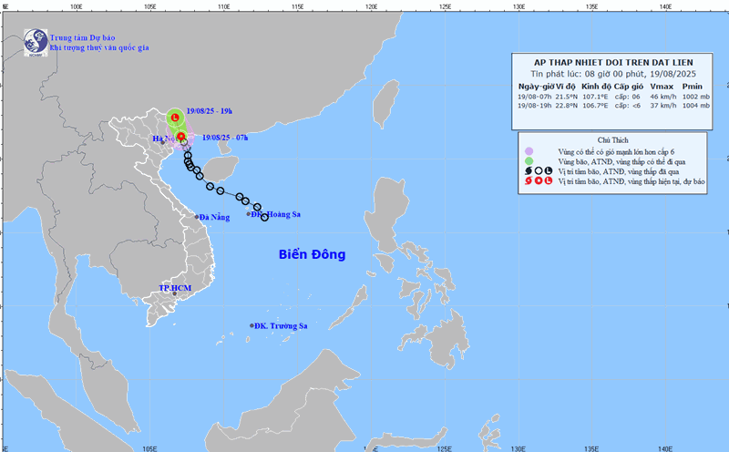
In the East Sea, on August 19, the northern sea area of the Gulf of Tonkin will have scattered showers and thunderstorms. At Bach Long Vy station, gusts of wind of level 7 were recorded.
In the evening and night of August 19, in the northern sea area of the Gulf of Tonkin, there will continue to be scattered showers and thunderstorms. During thunderstorms, there is a possibility of tornadoes, strong gusts of wind of level 6-7 and waves from 2.0-3.0 m high.
All ships operating in the above area are at risk of being affected by tornadoes and strong gusts of wind.


